MyTopo
Lena Lagoon Louisiana US Topo Map
Couldn't load pickup availability
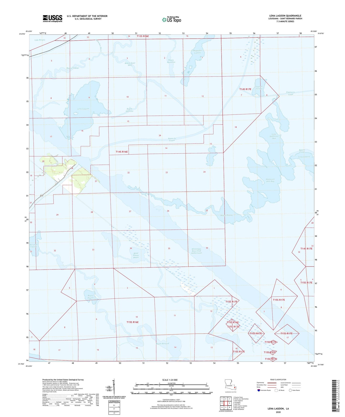
2024 topographic map quadrangle Lena Lagoon in the state of Louisiana. Scale: 1:24000. Based on the newly updated USGS 7.5' US Topo map series, this map is in the following counties: St. Bernard. The map contains contour data, water features, and other items you are used to seeing on USGS maps, but also has updated roads and other features. This is the next generation of topographic maps. Printed on high-quality waterproof paper with UV fade-resistant inks.
Quads adjacent to this one:
West: Yscloskey
Northwest: Proctor Point
North: Pointe aux Marchettes
Northeast: Lake Eugenie
East: Lake Eloi
Southeast: Lake Athanasio
South: Black Bay North
Southwest: Lake Cuatro Caballo
This map covers the same area as the classic USGS quad with code o29089g5.
Contains the following named places: Bayou Alphonse, Bayou Bernard, Bayou Guyago, Bayou Pisana, Bayou Saint Malo, Bernard Lagoon, Blind Pisana Bayou, Engineers Canal, Halfmoon Pass, Halfmoon Pass Bay, Jahnckes Ditch, Lagoon Brady, Lagoon Giraud, Lena Lagoon, Little Halfmoon Bay, Mississippi River-Gulf Outlet Canal, Pisana Lagoon