MyTopo
Pumpkin Islands Louisiana US Topo Map
Couldn't load pickup availability
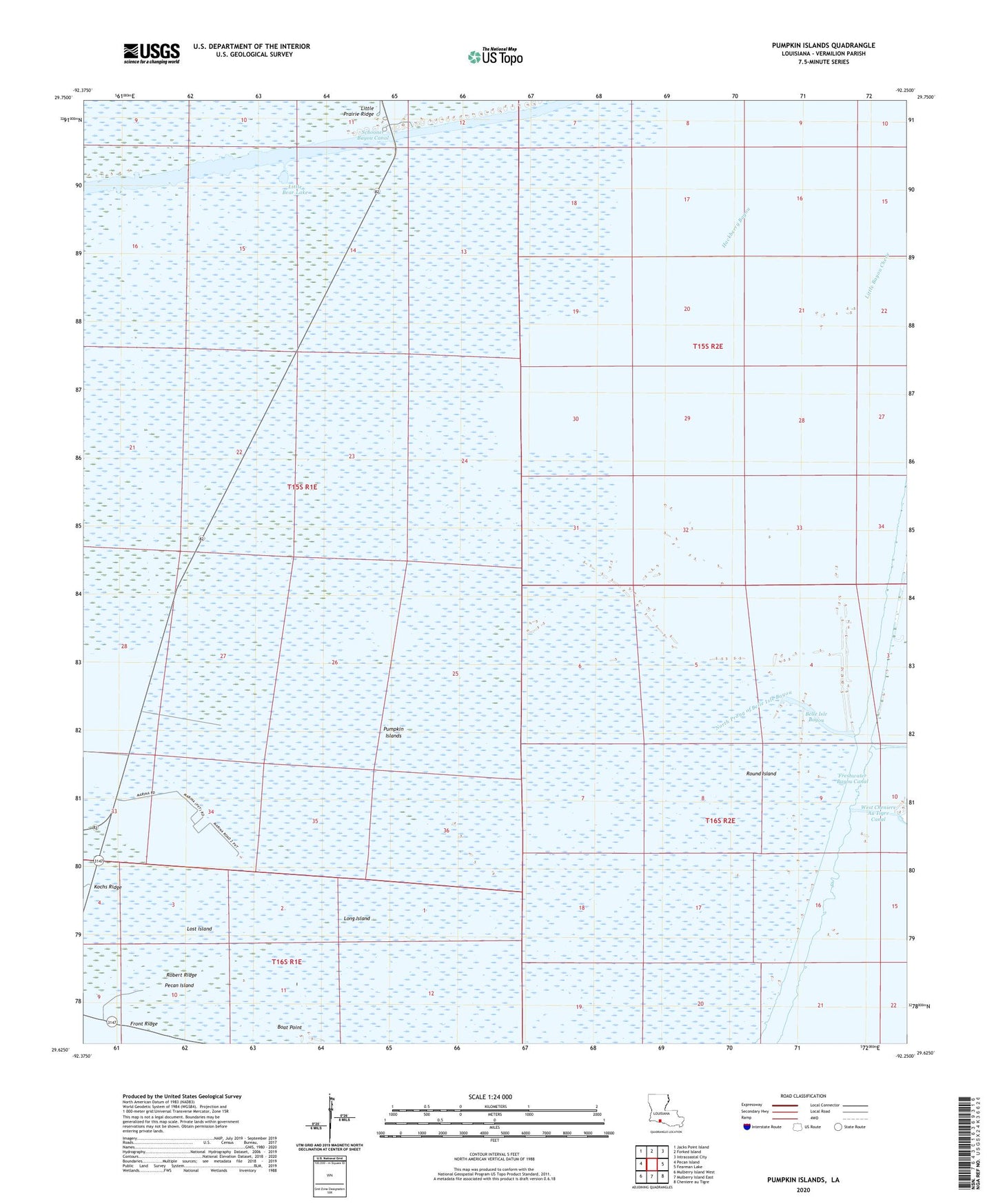
2024 topographic map quadrangle Pumpkin Islands in the state of Louisiana. Scale: 1:24000. Based on the newly updated USGS 7.5' US Topo map series, this map is in the following counties: Vermilion. The map contains contour data, water features, and other items you are used to seeing on USGS maps, but also has updated roads and other features. This is the next generation of topographic maps. Printed on high-quality waterproof paper with UV fade-resistant inks.
Quads adjacent to this one:
West: Pecan Island
Northwest: Jacks Point Island
North: Forked Island
Northeast: Intracoastal City
East: Fearman Lake
Southeast: Cheniere au Tigre
South: Mulberry Island East
Southwest: Mulberry Island West
This map covers the same area as the classic USGS quad with code o29092f3.
Contains the following named places: Belle Isle Bayou, Boat Point, East White Lake Oil and Gas Field, Freshwater Bayou Canal, Kochs Ridge, Little Bear Lake, Long Island, Lost Island, North Freshwater Bayou Heliport, North Prong of Belle Isle Bayou, Northern Freshwater Bayou Oil and Gas Field, Pumpkin Islands, Robert Ridge, Round Island, Schooner Bayou Canal, Ward Seven