MyTopo
Intracoastal City Louisiana US Topo Map
Couldn't load pickup availability
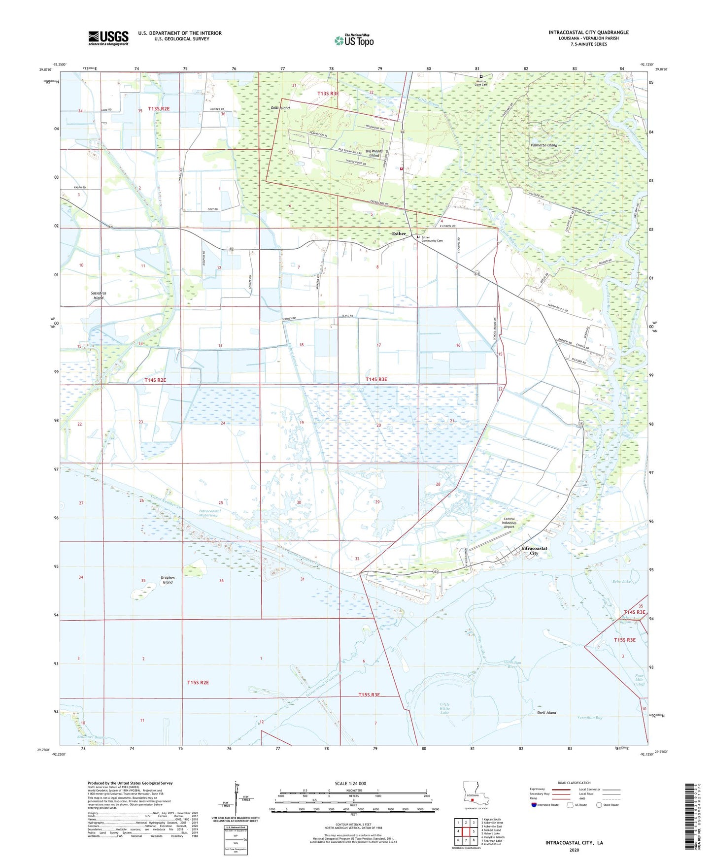
2024 topographic map quadrangle Intracoastal City in the state of Louisiana. Scale: 1:24000. Based on the newly updated USGS 7.5' US Topo map series, this map is in the following counties: Vermilion. The map contains contour data, water features, and other items you are used to seeing on USGS maps, but also has updated roads and other features. This is the next generation of topographic maps. Printed on high-quality waterproof paper with UV fade-resistant inks.
Quads adjacent to this one:
West: Forked Island
Northwest: Kaplan South
North: Abbeville West
Northeast: Abbeville East
East: Hebert Lake
Southeast: Redfish Point
South: Fearman Lake
Southwest: Pumpkin Islands
This map covers the same area as the classic USGS quad with code o29092g2.
Contains the following named places: Bayou Chene, Bayou Glad, Bayou Sorrow, Bebe Bayou, Bebe Lake, Big Woods Island, Central Industries Airport, Danny Richard Marina, Era Heliport, Esther, Esther Baptist Church, Esther Gas Field, Esther Post Office, Exxon Intracoastal City Terminal Seaplane Base, Four Mile Cutoff, Goat Island, Grophes Island, Hall-Schultz Canal, Hebert Canal, Hog Bayou, Intracoastal City, Intracoastal City Gas Field, Intracoastal City Heliport, Leland Bowman Lock, Little Bayou, Little White Lake, Live Oak Oil and Gas Field, Meaux Canal, Miller Island Canal, Mouton Cove Cemetery, North Buck Point Gas Field, Palmetto Island, Roy Lee Landing Strip, Sagrera Landing Strip, Saint James Catholic Church, Sassafras Island, Schooner Bayou, Seventh Ward Canal, Seventh Ward Volunteer Fire Department, Shell Island, Shell Morgan Landing, Southwest Esther Gas Field, Tenneco Intracoastal Heliport, Theall Gas Field, Union Oil Company of California Heliport, Vermilion River