MyTopo
Richard Louisiana US Topo Map
Couldn't load pickup availability
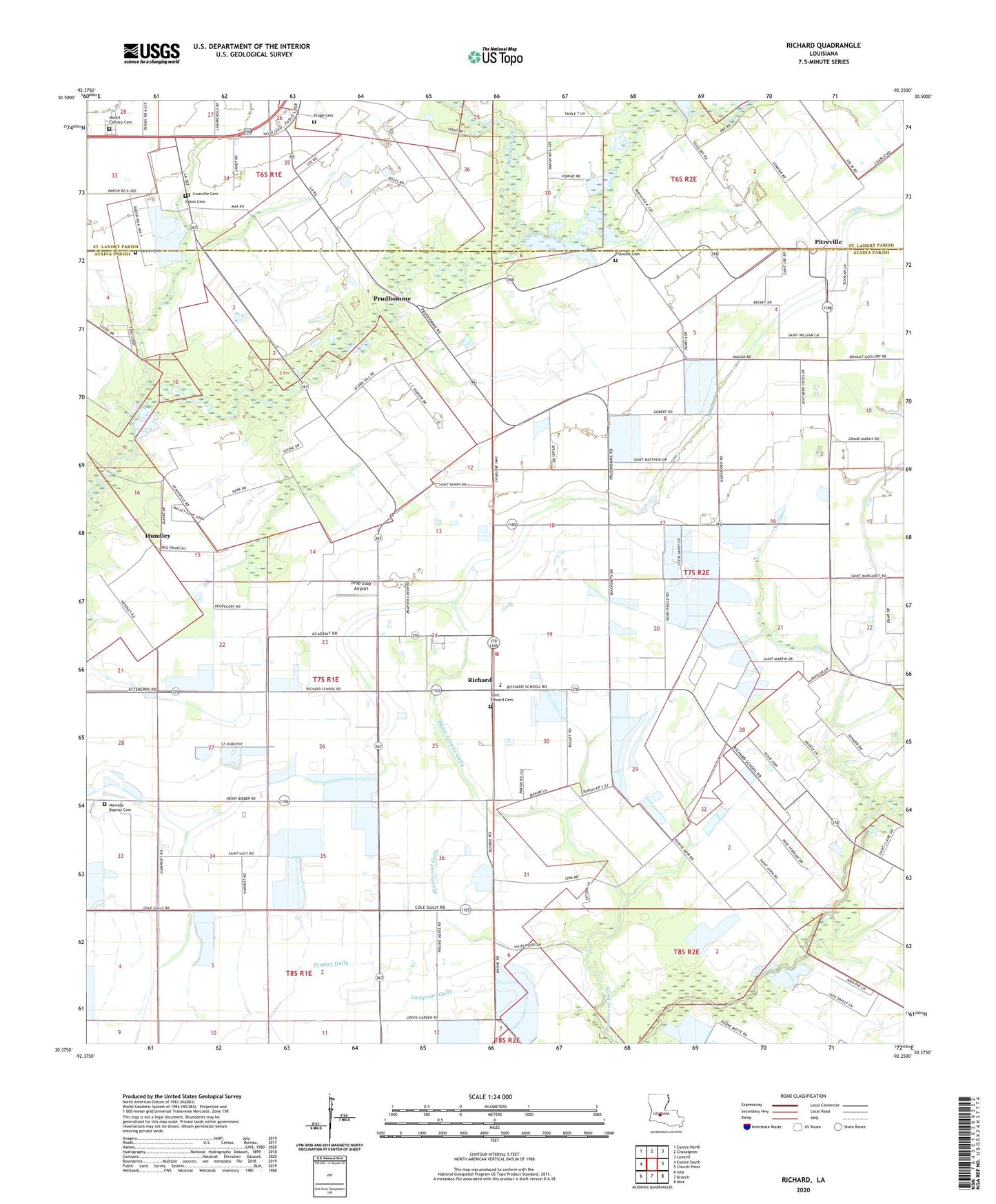
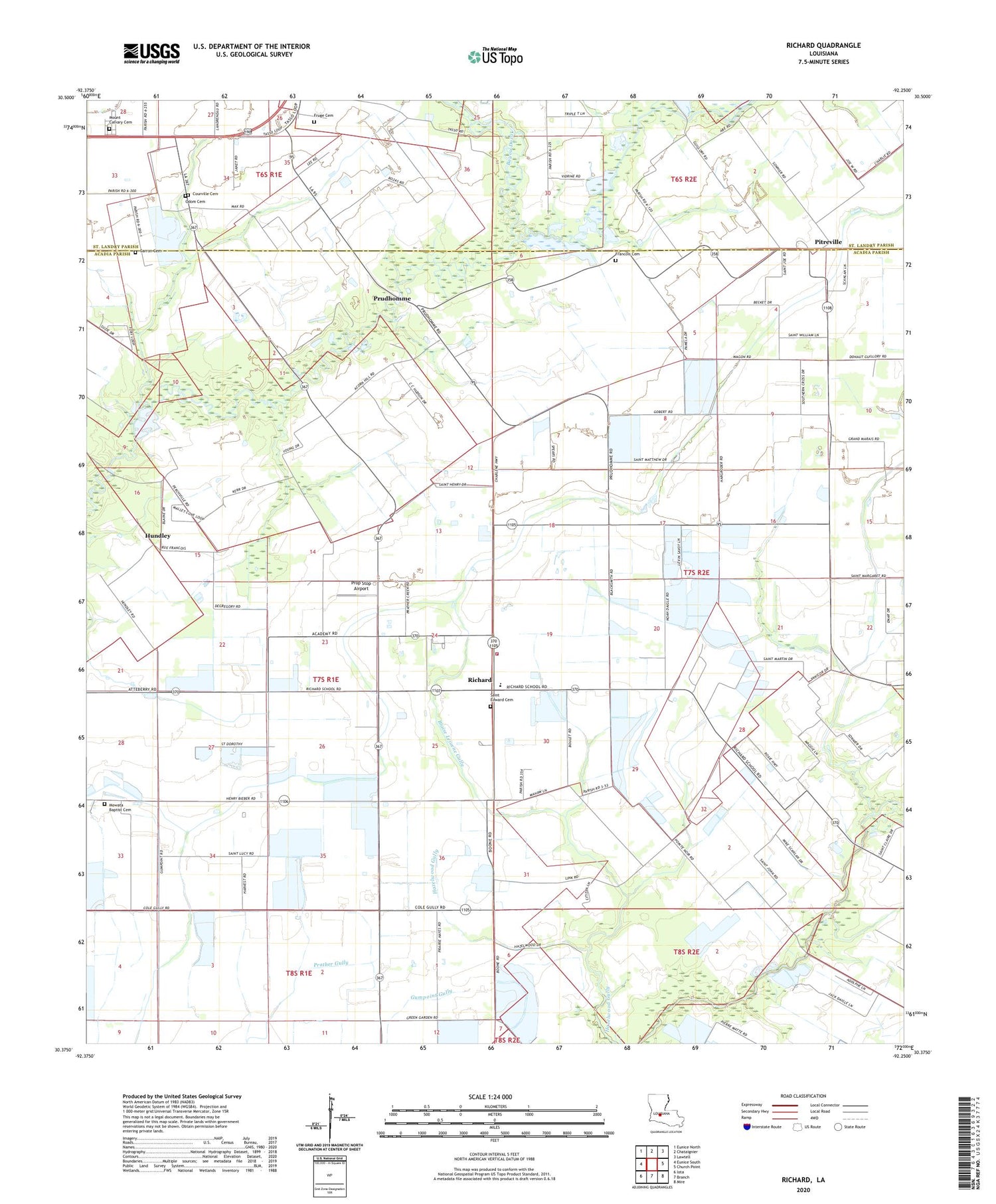
2020 topographic map quadrangle Richard in the state of Louisiana. Scale: 1:24000. Based on the newly updated USGS 7.5' US Topo map series, this map is in the following counties: Acadia, St. Landry. The map contains contour data, water features, and other items you are used to seeing on USGS maps, but also has updated roads and other features. This is the next generation of topographic maps. Printed on high-quality waterproof paper with UV fade-resistant inks.
Quads adjacent to this one:
West: Eunice South
Northwest: Eunice North
North: Chataignier
Northeast: Lawtell
East: Church Point
Southeast: Mire
South: Branch
Southwest: Iota
Contains the following named places: Acadia Academy, Bayou Doza, Bayou Mallet Oil and Gas Field, Blaise Lejuene Gully, Briscoe School, Carron Cemetery, Coe, Courville Cemetery, Daly School, Francois Cemetery, Fruge Cemetery, Grande Coulee Ditch, Hornsby School, Hundley, Hundley School, KJJB-FM (Eunice), Light and Tie School, Luscombe Lane 1 Airport, Miller Lake, Miller Lake Dam, Mount Calvary Cemetery, Mowata Baptist Cemetery, Mowato Church, Odom Cemetery, Parish Governing Authority District 13, Parish Governing Authority District 7, Pilgrims Rest Baptist Church, Pitreville, Pitreville School, Point Noir School, Prairie Cottereau, Prop Stop Airport, Prudhomme, Prudhomme School, Richard, Richard Elementary School, Richard School, Richard Volunteer Fire Department, S and S Landing Strip, Saint Edwards Church, Savoy School, South Bayou Mallet Oil and Gas Field, Trinity Baptist Church, Ward Six