MyTopo
Salter Creek Louisiana US Topo Map
Couldn't load pickup availability
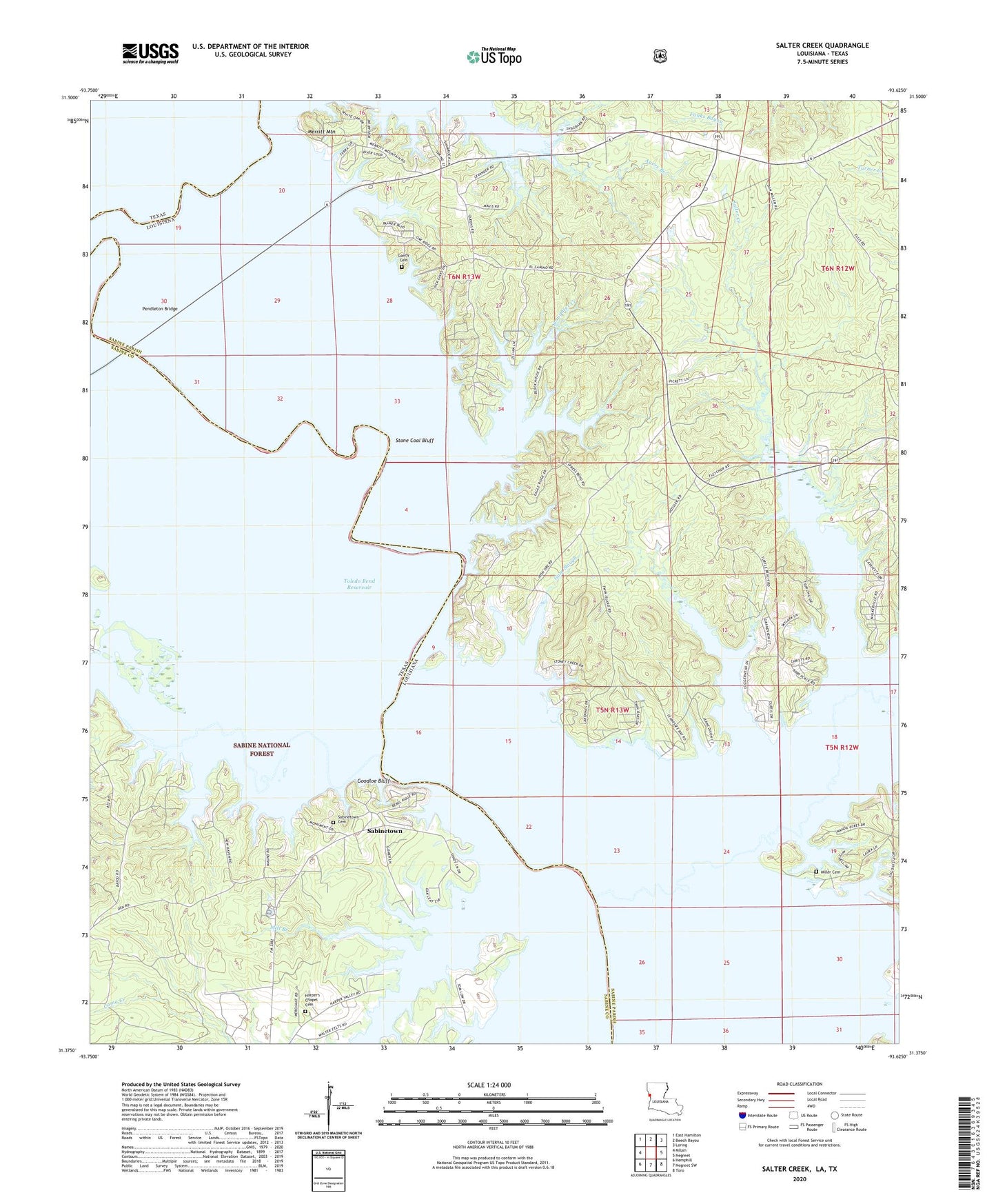
2020 topographic map quadrangle Salter Creek in the states of Louisiana, Texas. Scale: 1:24000. Based on the newly updated USGS 7.5' US Topo map series, this map is in the following counties: Sabine. The map contains contour data, water features, and other items you are used to seeing on USGS maps, but also has updated roads and other features. This is the next generation of topographic maps. Printed on high-quality waterproof paper with UV fade-resistant inks.
Quads adjacent to this one:
West: Milam
Northwest: East Hamilton
North: Beech Bayou
Northeast: Loring
East: Negreet
Southeast: Toro
South: Negreet SW
Southwest: Hemphill
Contains the following named places: Ayers Branch, Bayou Negreet, Beulah Church, Camp Sabine, Carrice Creek, Cypress Pond, Cyress Slash, Edison Camp Bend, Evergreen Church, Gandy Cemetery, Gilcrease Ferry, Goodloe Bluff, Gum Slough, Harpers Chapel, Harper's Chapel Cemetery, Louisiana Tourist Information Center, Lows Branch, Merritt Mountain, Mill Branch, Miller Cemetery, Miller School, Palo Gaucho Bayou, Patroon Bayou, Pendleton Bridge, Pendleton Church, Pendleton Ferry, Sabine Ferry, Sabinetown, Sabinetown Cemetery, Salter Creek, Siloam Church, Siloam School, Staughter Creek, Stone Coal Bluff, Thompsons Ferry, Tom Sawyer Church, Turtle Beach, Twin Island Campground