
MyTopo
Savage Creek Louisiana US Topo Map
Couldn't load pickup availability
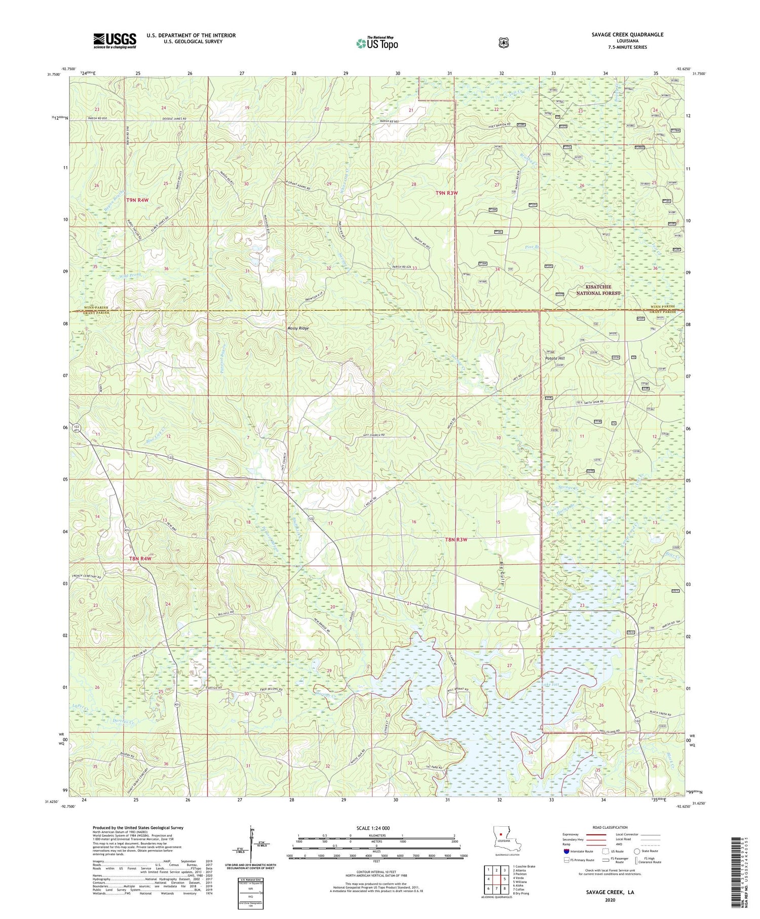
2020 topographic map quadrangle Savage Creek in the state of Louisiana. Scale: 1:24000. Based on the newly updated USGS 7.5' US Topo map series, this map is in the following counties: Grant, Winn. The map contains contour data, water features, and other items you are used to seeing on USGS maps, but also has updated roads and other features. This is the next generation of topographic maps. Printed on high-quality waterproof paper with UV fade-resistant inks.
Quads adjacent to this one:
West: Verda
Northwest: Coochie Brake
North: Atlanta
Northeast: Packton
East: Williana
Southeast: Dry Prong
South: Colfax
Southwest: Aloha
Contains the following named places: Bear Creek, Big Gully, Black Creek, Blue Lick Creek, Blue Lick Creek Oil Field, Bluff Lick Creek, Boggy Creek, Brushy Creek, Camp Pond Creek, Church of God, Dartigo Creek, Hurley Branch, Iatt, Iatt Church, Iatt Creek, LaPet Creek, Mossy Ridge, Oak Grove School, Parasol Bayou, Pine Branch, Potato Hill, Savage Creek, The Big Woods, Verda Lookout Tower, White Oak Creek, White Oak Creek Oil Field, Wild Prong


