MyTopo
Sheridan Louisiana US Topo Map
Couldn't load pickup availability
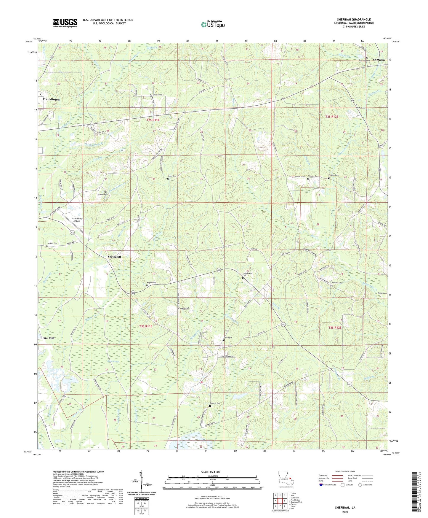
2024 topographic map quadrangle Sheridan in the state of Louisiana. Scale: 1:24000. Based on the newly updated USGS 7.5' US Topo map series, this map is in the following counties: Washington. The map contains contour data, water features, and other items you are used to seeing on USGS maps, but also has updated roads and other features. This is the next generation of topographic maps. Printed on high-quality waterproof paper with UV fade-resistant inks.
Quads adjacent to this one:
West: Franklinton
Northwest: Clifton
North: Pine
Northeast: State Line
East: Bogalusa West
Southeast: Sun
South: Enon
Southwest: Folsom
This map covers the same area as the classic USGS quad with code o30090g1.
Contains the following named places: Back Swamp, Bett Creek, Buckeye Branch, Burch Creek, Choctaw Road Landfill, Cooper School, Creel Cemetery, Ennis Branch, Franklinton Airport, Franklinton Country Club, Franklinton Elementary School, Franklinton High School, Jenkins Cemetery, Jesus Name Holiness Church, Letchworth Cemetery, Magee Cemetery, Miller Creek, Mount Zion Church, Oak Grove Church, Parish Governing Authority District 13, Parish Governing Authority District 2, Pine Cliff, Pond Branch, Poplarhead Church, Potato Patch Branch, Sandy Hollow Creek, Sanfords Camp, Sheridan, Simmons Cemetery, Smith Cemetery, Smith Pond Number One Dam, Spencer Cemetery, Springhill, Springhill Baptist Church, Strahan Cemetery, Thigpen Cemetery, Thomas Creek, Tison Cemetery, Ward Branch, Ward Six, Warner Creek, Washington Parish, Washington Parish Fire District 8, Williams Cemetery, Williams Mill, Witche Creek, ZIP Code: 70438