MyTopo
Enon Louisiana US Topo Map
Couldn't load pickup availability
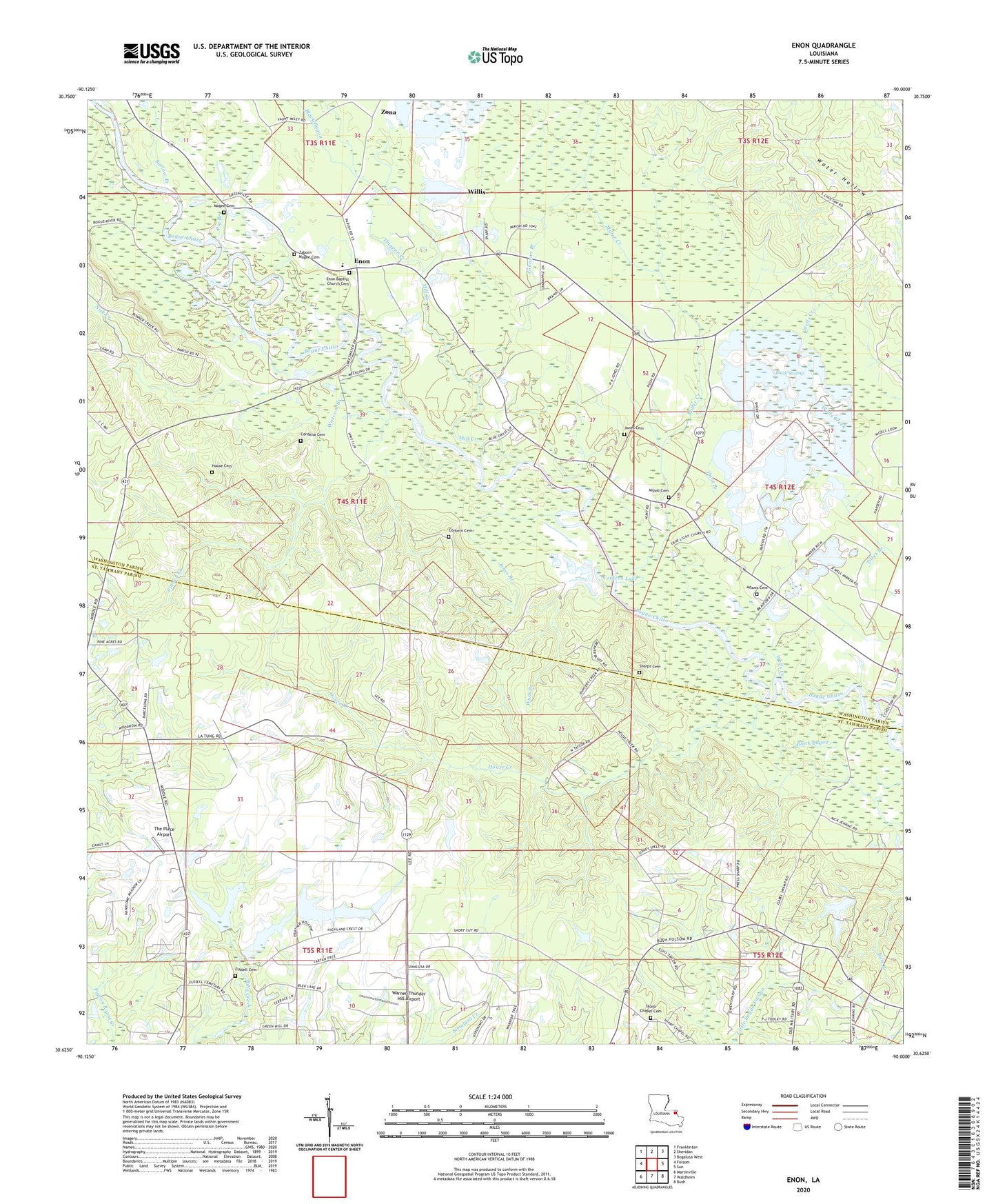
2024 topographic map quadrangle Enon in the state of Louisiana. Scale: 1:24000. Based on the newly updated USGS 7.5' US Topo map series, this map is in the following counties: Washington, St. Tammany. The map contains contour data, water features, and other items you are used to seeing on USGS maps, but also has updated roads and other features. This is the next generation of topographic maps. Printed on high-quality waterproof paper with UV fade-resistant inks.
Quads adjacent to this one:
West: Folsom
Northwest: Franklinton
North: Sheridan
Northeast: Bogalusa West
East: Sun
Southeast: Bush
South: Waldheim
Southwest: Martinville
This map covers the same area as the classic USGS quad with code o30090f1.
Contains the following named places: Adams Cemetery, Barlow Branch, Black Bayou, Black Swamp, Clearwater Creek, Cordelia Cemetery, Corkern Airport, Corkern Cemetery, Corkern Lake, Enon, Enon Baptist Church, Enon Elementary School, Enon Lookout Tower, Enon Post Office, Finney Creek, Fussell Cemetery, House Cemetery, House Creek, Huggins, Hunt Branch, Hurd, Isabel Baptist Church, Johnson Branch, Jones Branch, Jones Cemetery, Julia, Magee Cemetery, Mill Creek, Miller Creek, Mizell Cemetery, Nick Creek, Pig Branch, Price, Saint Tammany Parish Fire District 6 Station 3, Sharp Chapel Cemetery, Sharps Cemetery, Sharps Chapel, The Place Airport, Thigpen Creek, True Light Church, Warner-Thunder Hill Airport, Wascom Branch, Wash Branch, Washington Parish Library Enon Branch, Wells Creek, Willis, Zaborn Magee Cemetery, Zona