MyTopo
Tate Cove Louisiana US Topo Map
Couldn't load pickup availability
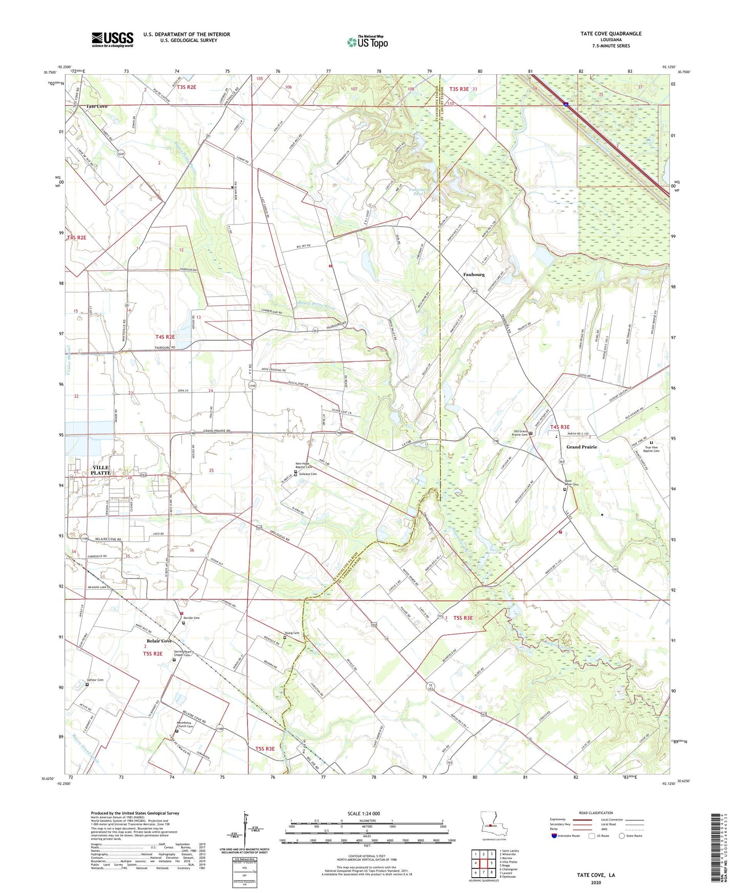
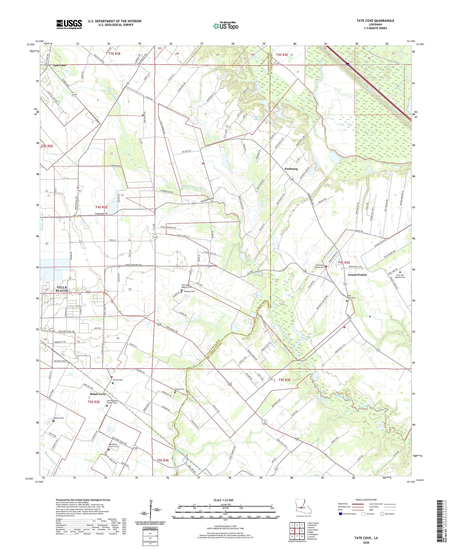
2020 topographic map quadrangle Tate Cove in the state of Louisiana. Scale: 1:24000. Based on the newly updated USGS 7.5' US Topo map series, this map is in the following counties: Evangeline, St. Landry. The map contains contour data, water features, and other items you are used to seeing on USGS maps, but also has updated roads and other features. This is the next generation of topographic maps. Printed on high-quality waterproof paper with UV fade-resistant inks.
Quads adjacent to this one:
West: Ville Platte
Northwest: Saint Landry
North: Whiteville
Northeast: Morrow
East: Beggs
Southeast: Opelousas
South: Lawtell
Southwest: Chataignier
Contains the following named places: Bayou Grand Louis, Bayou Grand Louis Gas Field, Bayou Petite Passe, Bel Aire Cove Volunteer Fire Department, Belair Cove, Cen-Tex Landing Strip, Deville Cemetery, Earl Fontenot Junior Pond Dam, Evangeline Parish Sheriff's Office, Faubourg, Faubourg Volunteer Fire Department, Fontenots Pond, Frilot Cove, Grand Prairie, Grand Prairie Church, Grand Prairie Elementary School, La Petite Airdrome, Lafleur Cemetery, Macedonia Baptist Church, Morhorm Church, New Hope Missionary Baptist Church, Old Grand Prairie Cemetery, Parish Governing Authority District 10, Parish Governing Authority District 4, Parish Governing Authority District 9, Sacred Heart Chapel, Saint Andrews Church, Saint Landry Parish Fire District 3 Station 6, Saint Peter Church, Soileaus Cemetery, Tate Cove, True Vine Church, Young Cemetery