MyTopo
Turnbull Island Louisiana US Topo Map
Couldn't load pickup availability
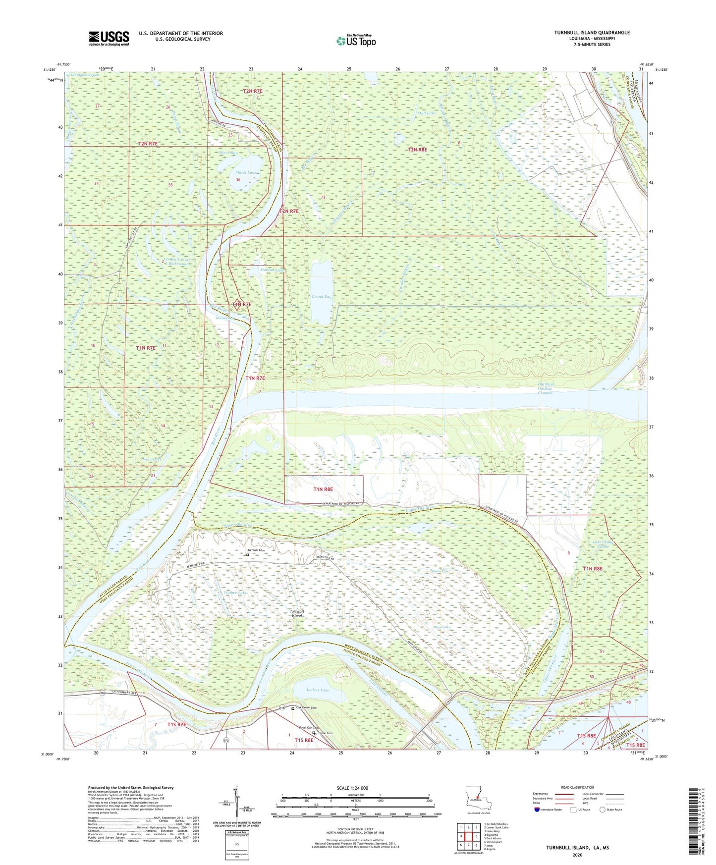
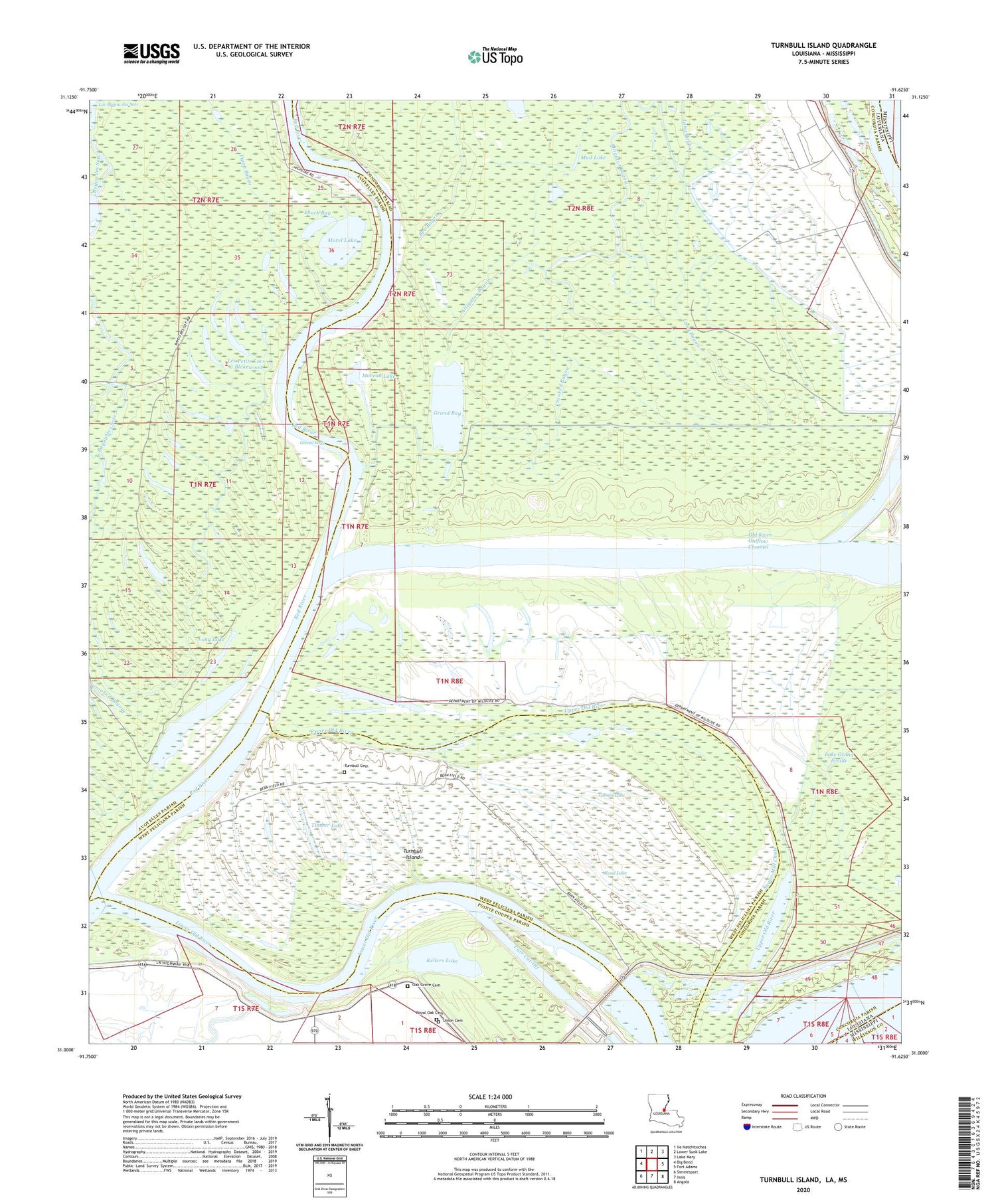
2020 topographic map quadrangle Turnbull Island in the state of Louisiana. Scale: 1:24000. Based on the newly updated USGS 7.5' US Topo map series, this map is in the following counties: Concordia, Avoyelles, West Feliciana, Pointe Coupee, Wilkinson. The map contains contour data, water features, and other items you are used to seeing on USGS maps, but also has updated roads and other features. This is the next generation of topographic maps. Printed on high-quality waterproof paper with UV fade-resistant inks.
Quads adjacent to this one:
West: Big Bend
Northwest: Ile Natchitoches
North: Lower Sunk Lake
Northeast: Lake Mary
East: Fort Adams
Southeast: Angola
South: Innis
Southwest: Simmesport
Contains the following named places: Above Old River Revetment, Ashridge, Barbre Landing, Bayou Dindy, Belair Plantation, Chandler Landing, Cockleburr Bay, Coochie Revetment, Crooked Bayou, Evening Star Church, Flat Lake, Gibson Lake, Grand Bay, Grand Lake, Kellers Lake, Kellers Plantation, King Solomon Church, King Solomon School, Les Petits Lacs a Blakewood, Long Bayou, Long Lake, Lower Ballymagan Oil Field, Lower Old River, Marcotte Landing, Martin Bay, Merrick, Moreau Lake, Morel Lake, Mud Lake, Naples, North Bank Revetment, Oak Grove Cemetery, Oak Grove Church, Oak Grove School, Old River Lock, Old River Outflow Channel, Pump Bayou, Quarter Lake, Red River, Road Lake, Royal Oak Cemetery, Royal Oak Church, Shark Bay, Spanish Fort, Sugar Mill Chute, Three Rivers Wildlife Management Area, Timber Lake, Torras Community School, True Vine Church, Turnbull Cemetery, Turnbull Island, Turnbull Island Revetment, Union Chapel, Union Chapel Cemetery, Upper Old River