MyTopo
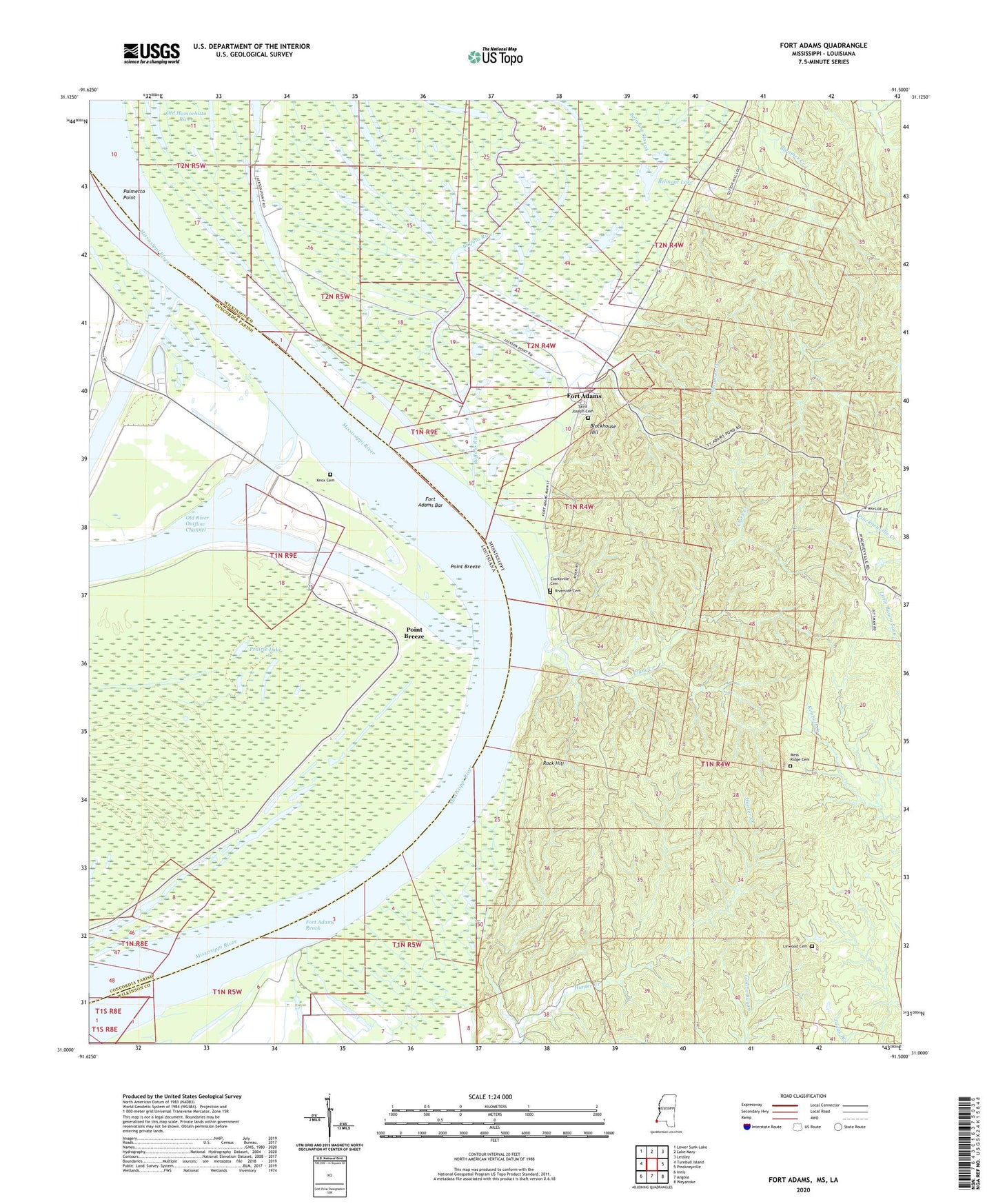
Fort Adams Mississippi US Topo Map
Couldn't load pickup availability
2024 topographic map quadrangle Fort Adams in the states of Mississippi, Louisiana. Scale: 1:24000. Based on the newly updated USGS 7.5' US Topo map series, this map is in the following counties: Wilkinson, Concordia. The map contains contour data, water features, and other items you are used to seeing on USGS maps, but also has updated roads and other features. This is the next generation of topographic maps. Printed on high-quality waterproof paper with UV fade-resistant inks.
Quads adjacent to this one:
West: Turnbull Island
Northwest: Lower Sunk Lake
North: Lake Mary
Northeast: Lessley
East: Pinckneyville
Southeast: Weyanoke
South: Angola
Southwest: Innis
This map covers the same area as the classic USGS quad with code o31091a5.
Contains the following named places: Arcole Plantation, Belmont Lake, Belmont Lake Oil Field, Blockhouse Hill, Buffalo River, Clark Creek, Clarksville Cemetery, Cochie Oil Field, Coochie, Fort Adams, Fort Adams Bar, Fort Adams Landing, Fort Adams Oil Field, Fort Adams Reach, Fort Adams Reach Revetment, Glendale Plantation, Hunter Hall Plantation, Knox Cemetery, Knox Church, Knox Landing, Knox Plantation, Knox School, Linwood Cemetery, Linwood Plantation, Lum Landing, Lum Point Plantation, Mess Ridge Cemetery, Mount Olive Church, Mount Olive School, Mount Ricca School, North Fort Adams Oil Field, Old River Control Complex, Old River Control Structure, Old River Ctl Auxillary Structure Heliport, Palmetto Point, Pickneyville Oil Field, Point Breeze, Point Breeze Church, Point Breeze Plantation, Point Breeze Revetment, Pond, Pond Oil Field, Prairie Lake, Riverside Cemetery, Rock Hill, Saint Joseph Cemetery, Saint Joseph Church, South Bank Revetment, Stamps Landing, Stamps Oil Field, Stamps Plantation, Tarbert Plantation, Tarberts Landing, Three Rivers State Wildlife Management Area, White Vine Plantation, Zion Hill Church


