MyTopo
Vivian North Louisiana US Topo Map
Couldn't load pickup availability
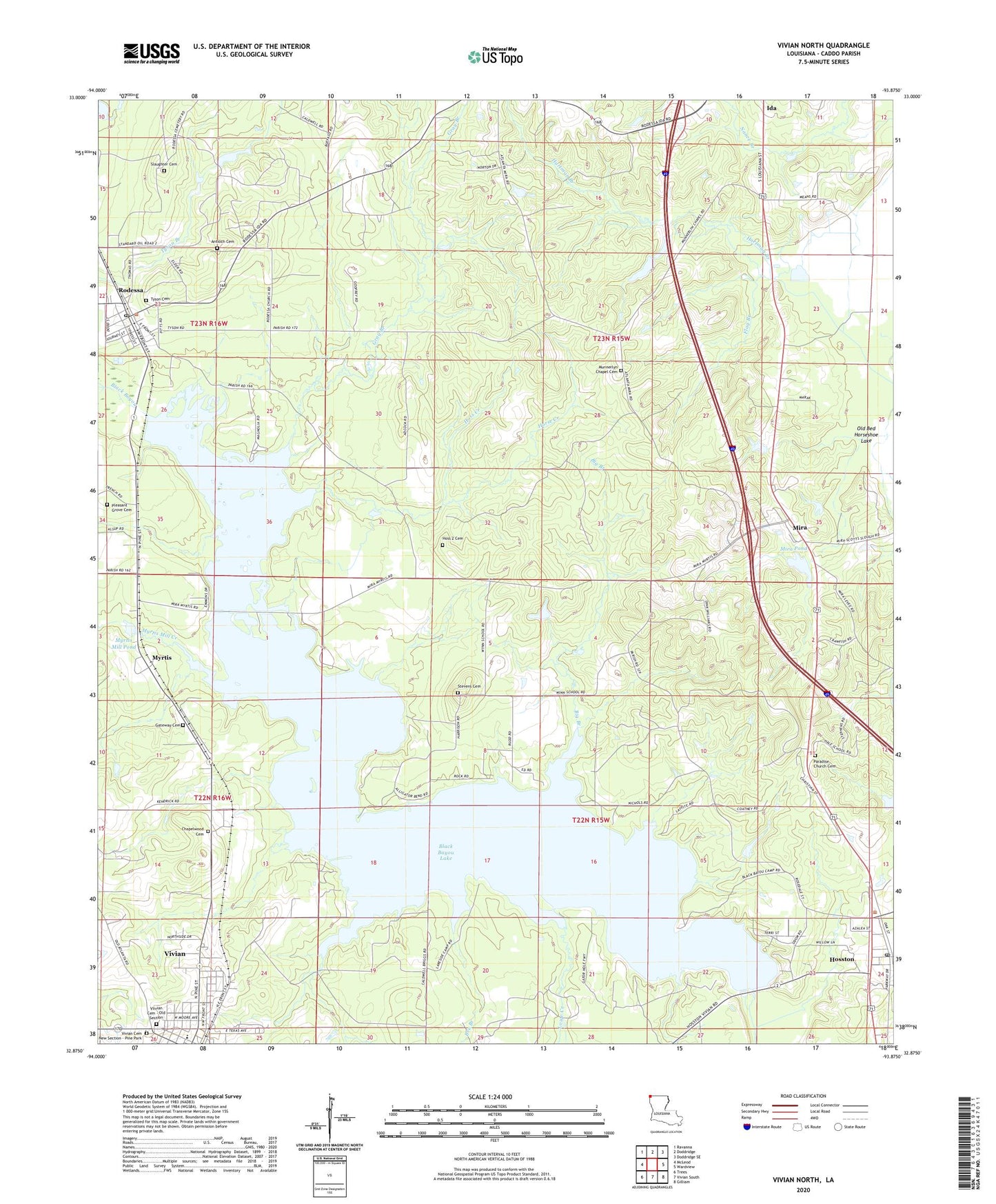
2020 topographic map quadrangle Vivian North in the state of Louisiana. Scale: 1:24000. Based on the newly updated USGS 7.5' US Topo map series, this map is in the following counties: Caddo. The map contains contour data, water features, and other items you are used to seeing on USGS maps, but also has updated roads and other features. This is the next generation of topographic maps. Printed on high-quality waterproof paper with UV fade-resistant inks.
Quads adjacent to this one:
West: McLeod
Northwest: Ravanna
North: Doddridge
Northeast: Doddridge SE
East: Wardview
Southeast: Gilliam
South: Vivian South
Southwest: Trees
Contains the following named places: Antioch Cemetery, Antioch Church, Arkadelphia Church, Bee Branch, Big Branch, Black Bayou Dam, Black Bayou Lake, Caddo Pine Island Oil Field, Caddo Prairie Church, Chapelwood Cemetery, Colquitt Church, Frog Level, Gray Branch, Hartman Branch, Horse Creek, Hoss Creek, Hosston, Hosston Oil and Gas Field, Hosston Post Office, KNCB-AM (Vivian), Lowe Creek, Mira, Mira Lookout Tower, Mira Oil Field, Mira Pond, Mira Pond Dam, Munnerlyn Chapel, Myrtis, Myrtis Mill Creek, Myrtis Mill Pond, Myrtis Mill Pond Dam, Nazarene Christian Academy School, North Caddo Community School, North Caddo Elementary Middle School, Old Bed Horseshoe Lake, Paradise Church, Pine Valley School, Pleasant Grove Church, Rodessa, Rodessa Oil and Gas Field, Rodessa Post Office, Saint Marks Church, Saint Matthew Church, Slaughter Cemetery, Stevens Cemetery, Thomas Church, VIivian Cemetery - Old Section, Village of Hosston, Village of Rodessa, Vivian Cemetery New Section - Pine Park, Vivian Middle School, Ward Nine, ZIP Codes: 71043, 71044, 71069