MyTopo
Trees Louisiana US Topo Map
Couldn't load pickup availability
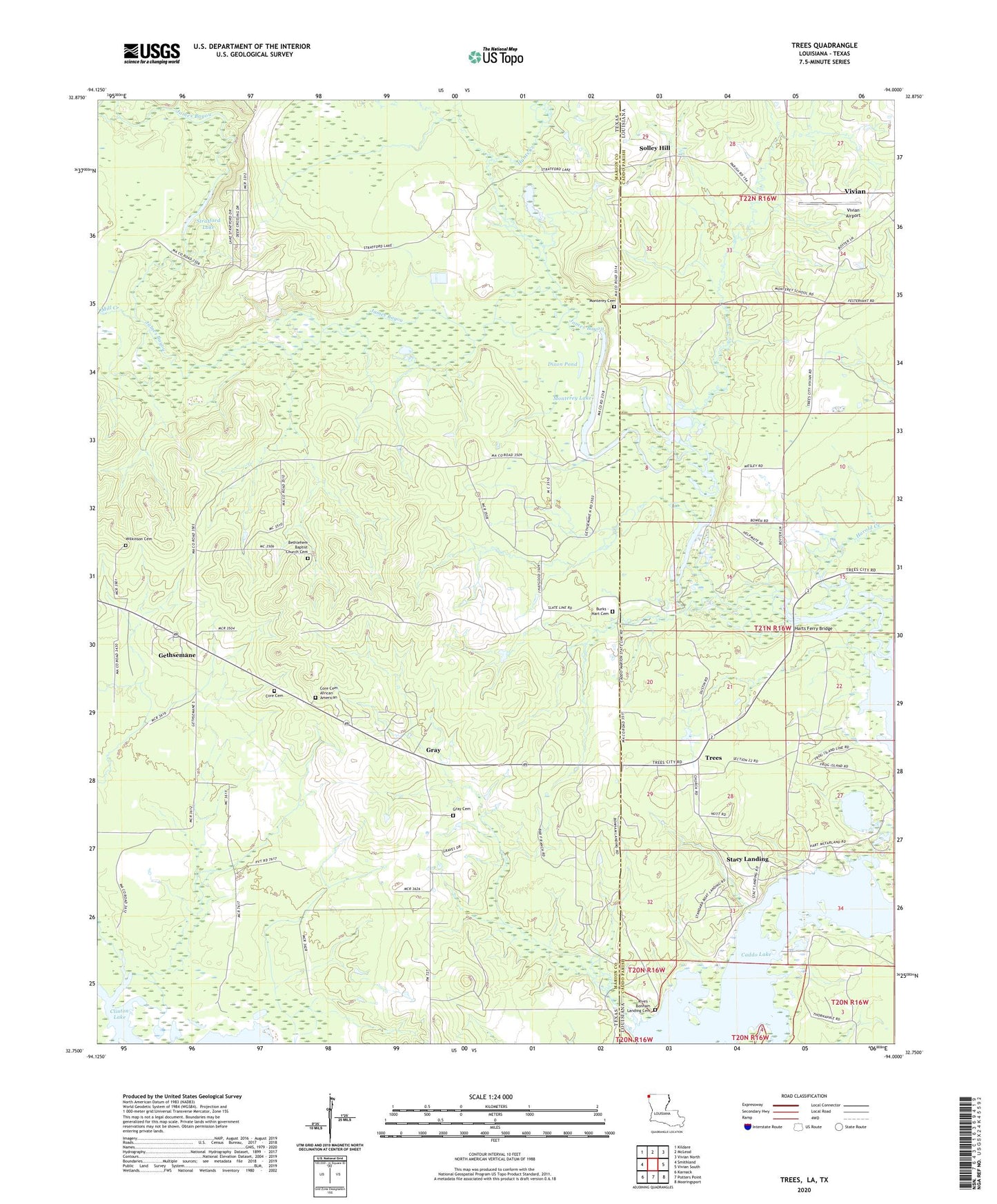
2024 topographic map quadrangle Trees in the states of Texas, Louisiana. Scale: 1:24000. Based on the newly updated USGS 7.5' US Topo map series, this map is in the following counties: Caddo, Marion. The map contains contour data, water features, and other items you are used to seeing on USGS maps, but also has updated roads and other features. This is the next generation of topographic maps. Printed on high-quality waterproof paper with UV fade-resistant inks.
Quads adjacent to this one:
West: Smithland
Northwest: Kildare
North: McLeod
Northeast: Vivian North
East: Vivian South
Southeast: Mooringsport
South: Potters Point
Southwest: Karnack
Contains the following named places: Bethlehem Church, Bonham Landing, Burks - Hart Cemetery, Caddo Station, Core Cemetery, Dixon Pond, Frazier Creek, Gethsemane, Gray, Gray Cemetery, Harold Creek, Harts Ferry Bridge, Hunts Creek, James Bayou, Jim Bayou, Mill Creek, Mission Chapel, Monterey, Monterey Cemetery, Monterey Lake, Potter Oil Field, Solley Hill, Stacy Landing, Stratford Lake, Trees, Trees Post Office, Union Church, Vivian Airport, Vivian Oil Field