MyTopo
Gilliam Louisiana US Topo Map
Couldn't load pickup availability
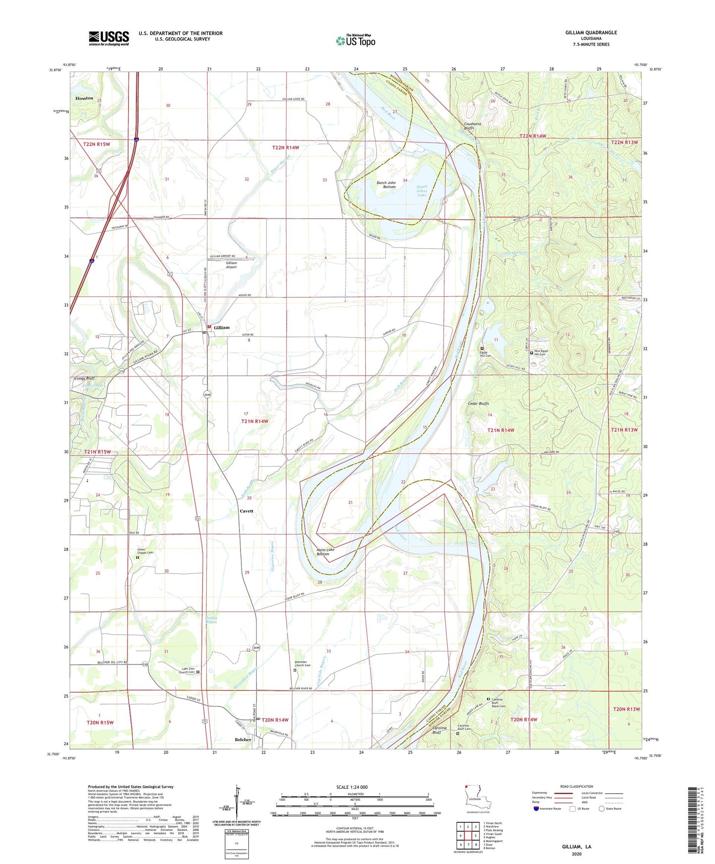
2024 topographic map quadrangle Gilliam in the state of Louisiana. Scale: 1:24000. Based on the newly updated USGS 7.5' US Topo map series, this map is in the following counties: Caddo, Bossier. The map contains contour data, water features, and other items you are used to seeing on USGS maps, but also has updated roads and other features. This is the next generation of topographic maps. Printed on high-quality waterproof paper with UV fade-resistant inks.
Quads adjacent to this one:
West: Vivian South
Northwest: Vivian North
North: Wardview
Northeast: Plain Dealing
East: Hughes
Southeast: Benton
South: Dixie
Southwest: Mooringsport
This map covers the same area as the classic USGS quad with code o32093g7.
Contains the following named places: Alligator Slough, Belcher Post Office, Bird Branch, Caddo Community Chapel, Carolina Bluff, Carolina Bluff Black Cemetery, Carolina Bluff Cemetery, Cavett, Cedar Bluffs, Collinsburg Creek, Cottage Grove Oil and Gas Field, Coushatta Bluffs, Dan White School, Dooley Swamp, Dutch John Bottom, Dutch John Branch, Dutch Johns Lake, Ebenezer Church, Egypt Hill Cemetery, Egypt Hill Church, Elizabeth Church, Elmer Slough, Elmore School, Fish Bayou, Galilee School, Gilliam, Gilliam Airport, Gilliam Post Office, Gilmer Ferry, Glycerine Bayou, Herndon Magnet School, Holm Lake Bottom, Irvings Bluff, Justice Chapel, Lane, Lee Chapel, Macks Lake, New Avery Church, New Bethel Church, New Egypt Hill Cemetery, New Light Church, Ollie Holm Lake, Ollie Holm Lake Dam, Peru Ferry, Pine Bluff Ferry, Pleasant Grove Church, Red Bayou, Rosenwald School, Rush Point Ferry, Saint Elmo Church, Silver Lake Creek, Union Chapel, Union Chapel Cemetery, Village of Belcher, Village of Gilliam, Ward One, Williams Chapel, ZIP Code: 71029