MyTopo
Vivian South Louisiana US Topo Map
Couldn't load pickup availability
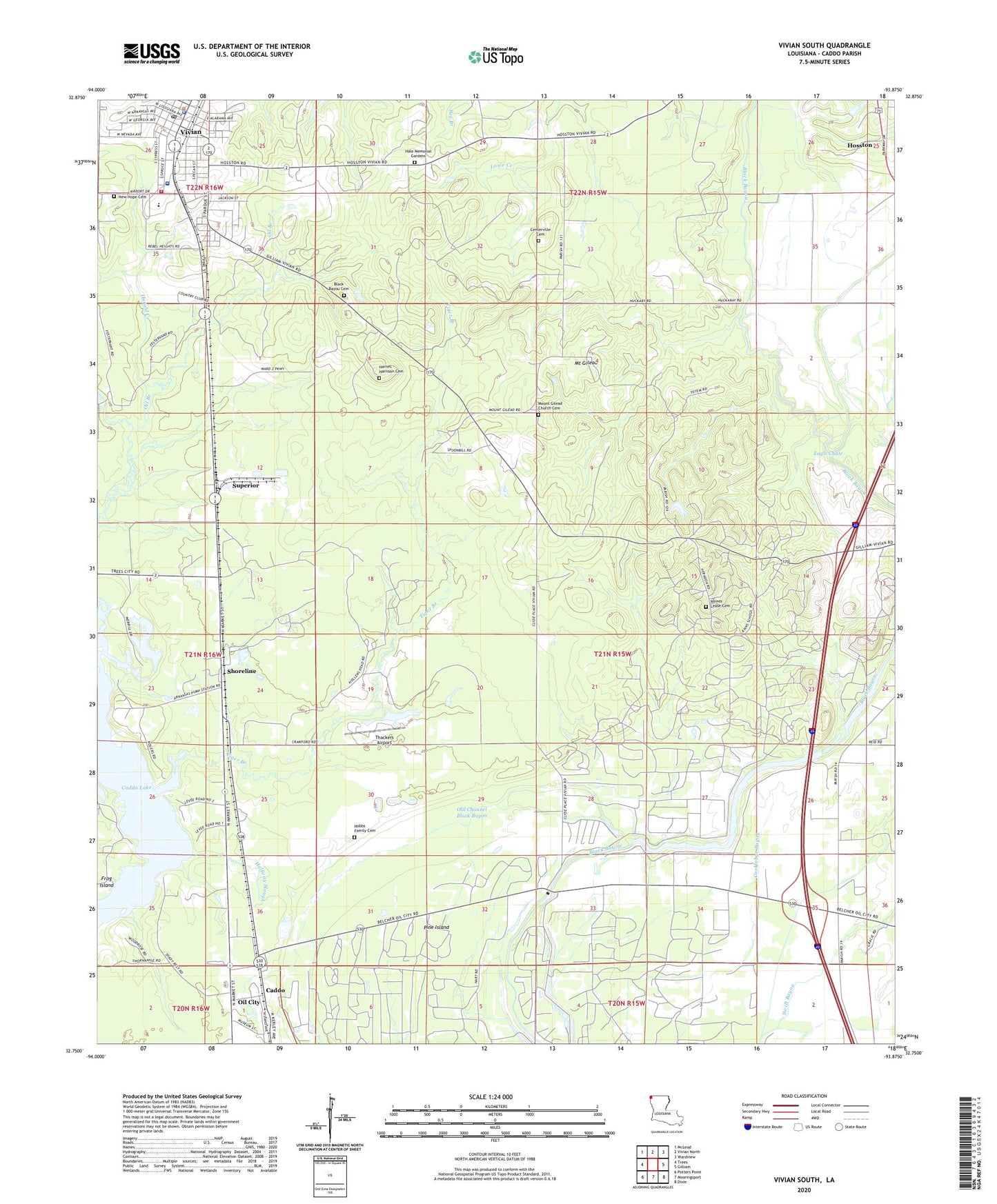
2024 topographic map quadrangle Vivian South in the state of Louisiana. Scale: 1:24000. Based on the newly updated USGS 7.5' US Topo map series, this map is in the following counties: Caddo. The map contains contour data, water features, and other items you are used to seeing on USGS maps, but also has updated roads and other features. This is the next generation of topographic maps. Printed on high-quality waterproof paper with UV fade-resistant inks.
Quads adjacent to this one:
West: Trees
Northwest: McLeod
North: Vivian North
Northeast: Wardview
East: Gilliam
Southeast: Dixie
South: Mooringsport
Southwest: Potters Point
This map covers the same area as the classic USGS quad with code o32093g8.
Contains the following named places: Black Bayou, Black Bayou Cemetery, Bradford Chapel, Brent, Caddo, Caddo Parish Fire District 8, Caddo-Pine Island Oil and Gas Field, Centerville Cemetery, Cocklebur Bayou, Eagle Chute, Frog Island, Goose Pond, Halfway Slough, Harrell - Harrison Cemetery, Kelly Bayou, Mail Boxes, Mount Gilead, Mount Gilead Church, Mount Olive Church, Mount Superior Church, Nazarene Church, New Hope Cemetery, New Hope Church, North Caddo Magnet High School, North Caddo Medical Center, Oil Branch, Old Channel Black Bayou, Parish Governing Authority District 1, Pine Island, Pine Island Church, Raines Lease Cemetery, Reno Hill Church, Rogers Station, Rosenwald School, Saint John Church, Shoreline, Superior, Swift Bayou Canal, Thackers Airport, Tiger Branch, Town of Vivian, Union Chapel, Vivian, Vivian Police Department, Vivian Post Office, Ward Two, ZIP Codes: 71061, 71082