MyTopo
Wardview Louisiana US Topo Map
Couldn't load pickup availability
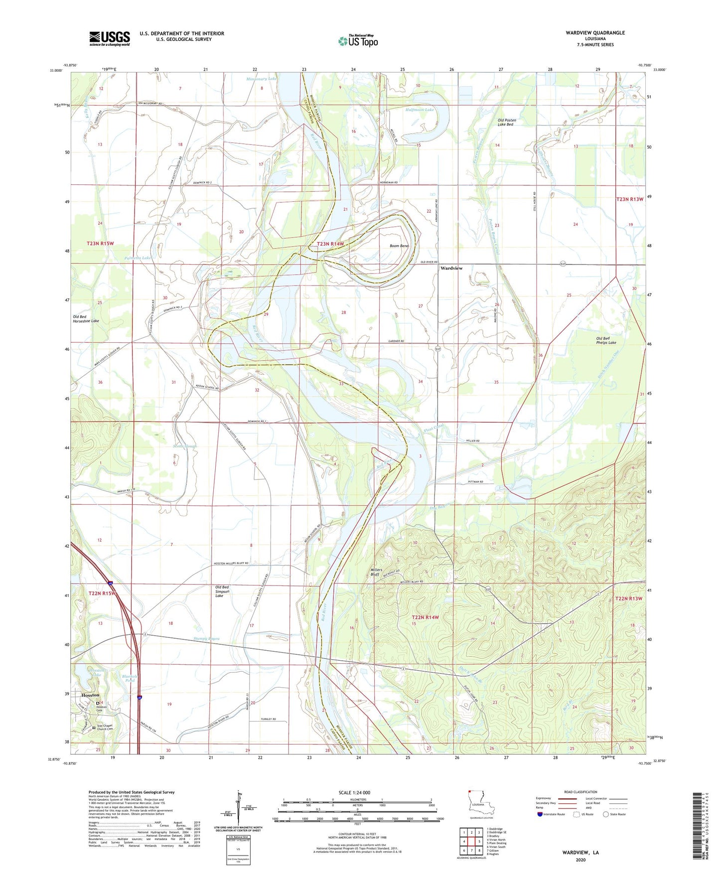
2024 topographic map quadrangle Wardview in the state of Louisiana. Scale: 1:24000. Based on the newly updated USGS 7.5' US Topo map series, this map is in the following counties: Bossier, Caddo. The map contains contour data, water features, and other items you are used to seeing on USGS maps, but also has updated roads and other features. This is the next generation of topographic maps. Printed on high-quality waterproof paper with UV fade-resistant inks.
Quads adjacent to this one:
West: Vivian North
Northwest: Doddridge
North: Doddridge SE
Northeast: Bradley
East: Plain Dealing
Southeast: Hughes
South: Gilliam
Southwest: Vivian South
This map covers the same area as the classic USGS quad with code o32093h7.
Contains the following named places: Black Lake Swamp, Bluehole Pond, Boom Bend, Bright Morning Star Church, Cavett School, Colquitt Church, Ditch Number One, Dry Bayou, Flag Branch, Float Canal, Halfmoon Lake, Hosston Alternative School, Hosston Cemetery, Hosston Lake, Hosston Lake Dam, Kelly Bayou, Kelly Bayou Canal, Miller Bluff Ferry, Millers Bluff, Millers Bluff Oil and Gas Field, Missionary School, Old Bed Phelps Lake, Old Bed Simpson Lake, Old Posten Lake Bed, Old River, O'Rourke Canal, Palmetta Lake, Pilgrim Rest Church, Posten Bayou, Posten Bayou Canal, Postens Lake, River Valley Church, Saint Mary Church, Scotts Slough, Simpson Lake Oil and Gas Field, Simpsons Lake, Star Chapel School, Stumpy Bayou, Wardview, Wardview Oil Field