MyTopo
Allagash Maine US Topo Map
Couldn't load pickup availability
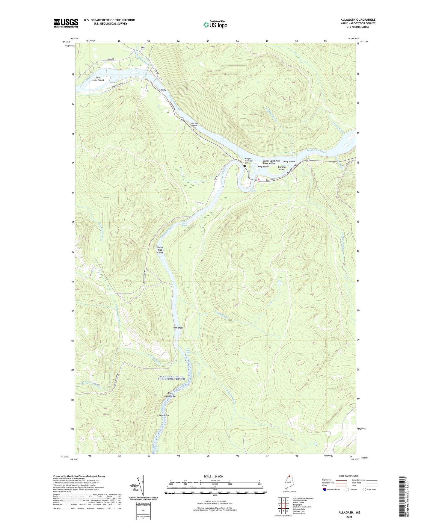
2024 topographic map quadrangle Allagash in the state of Maine. Scale: 1:24000. Based on the newly updated USGS 7.5' US Topo map series, this map is in the following counties: Aroostook. The map contains contour data, water features, and other items you are used to seeing on USGS maps, but also has updated roads and other features. This is the next generation of topographic maps. Printed on high-quality waterproof paper with UV fade-resistant inks.
Quads adjacent to this one:
West: Big Rapids
Northwest: Johnson Brook Mountain
North: Falls Brook Lake
Northeast: Saint Francis
East: Pelletier Brook Lakes
Southeast: Gardner Pond
South: McKeen Lake
Southwest: Allagash Falls
This map covers the same area as the classic USGS quad with code o47069a1.
Contains the following named places: Aegan Brook, Allagash, Allagash Consolidated School, Allagash Fire Department, Allagash Inn, Allagash Municipal Cemetery, Allagash River, Casey Brook, Casey Rapids, Depot Bar, Dickey, East Twin Brook, Eliza Hole Rapids, Faye O'Leary Hafford Library, Gardner Island, Gerald Brook, Ghost Landing Bar, Hafford Brook, Hog Island, Kelly School, Lewis Brook, Lindberg School, Little Black River, North Branch West Twin Brook, Pelletier Brook, Saint Clair Island, Saint Paul Catholic Cemetery, South Branch West Twin Brook, Three Mile Island, Town of Allagash, Twin Brook, Twin Brook Rapids, West Twin Brook, Wolf Island