MyTopo
Big Rapids Maine US Topo Map
Couldn't load pickup availability
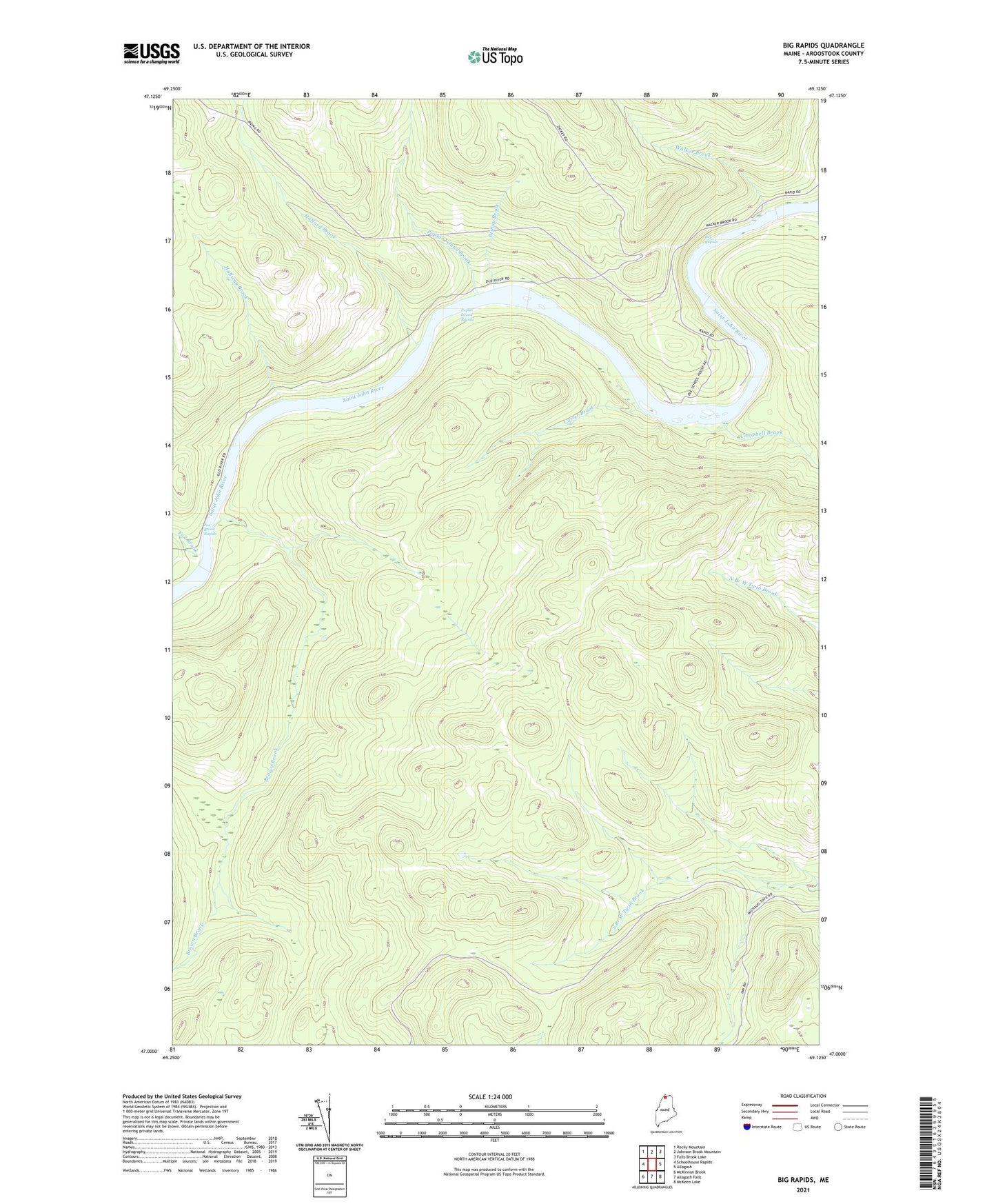
2024 topographic map quadrangle Big Rapids in the state of Maine. Scale: 1:24000. Based on the newly updated USGS 7.5' US Topo map series, this map is in the following counties: Aroostook. The map contains contour data, water features, and other items you are used to seeing on USGS maps, but also has updated roads and other features. This is the next generation of topographic maps. Printed on high-quality waterproof paper with UV fade-resistant inks.
Quads adjacent to this one:
West: Schoolhouse Rapids
Northwest: Rocky Mountain
North: Johnson Brook Mountain
Northeast: Falls Brook Lake
East: Allagash
Southeast: McKeen Lake
South: Allagash Falls
Southwest: McKinnon Brook
This map covers the same area as the classic USGS quad with code o47069a2.
Contains the following named places: Big Rapids, Bishop Brook, Brown Brook, Campbell Brook, Carter Brook, Fox Brook, Fox Brook Rapids, Hafford Brook, Halfway Brook, Log Cabin School, Poplar Island Brook, Poplar Island Rapids, Walker Brook, ZIP Code: 04774