MyTopo
Lily Bay Maine US Topo Map
Couldn't load pickup availability
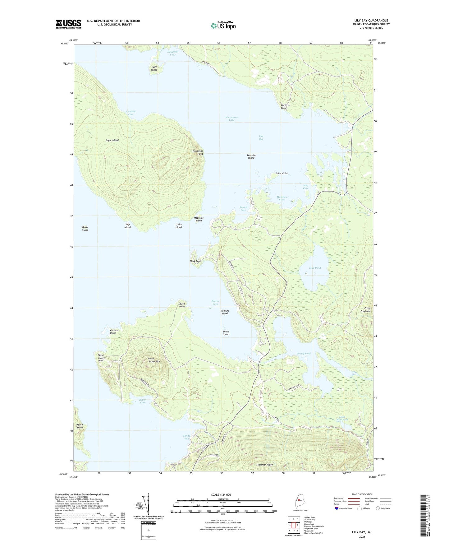
2024 topographic map quadrangle Lily Bay in the state of Maine. Scale: 1:24000. Based on the newly updated USGS 7.5' US Topo map series, this map is in the following counties: Piscataquis. The map contains contour data, water features, and other items you are used to seeing on USGS maps, but also has updated roads and other features. This is the next generation of topographic maps. Printed on high-quality waterproof paper with UV fade-resistant inks.
Quads adjacent to this one:
West: Moosehead
Northwest: Mount Kineo
North: Spencer Bay
Northeast: Kokadjo
East: Number Four Mountain
Southeast: Barren Mountain West
South: Greenville
Southwest: Big Moose Pond
This map covers the same area as the classic USGS quad with code o45069e5.
Contains the following named places: Beaver Cove, Beaver Creek, Birch Island, Birch Point, Black Point, Bolton Cove, Burgess Brook, Burnt Jacket Mountain, Burnt Jacket Point, Caribou Point, Carleton Point, Dollar Island, Doughnut Cove, Galusha Cove, Hyde Island, Laker Point, Lily Bay, Lily Bay Brook, Lily Bay State Park, Little Mud Pond, Mathews Cove, McCuller Island, Mud Brook, Mud Cove, Mud Pond, North Brook, Porcupine Point, Prong Pond, Rowell Cove, Sandy Bay, Scammon Ridge, Ship Island, Snake Island, South Brook, Sugar Island, Treasure Island, Tussle Brook, Tussle Lagoon, Twomile Island