MyTopo
Basin Mountain Maine US Topo Map
Couldn't load pickup availability
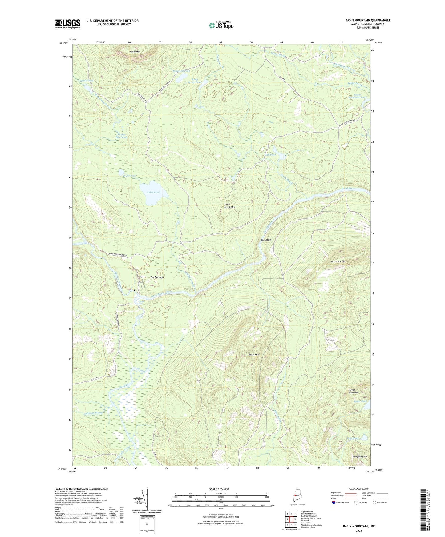
2021 topographic map quadrangle Basin Mountain in the state of Maine. Scale: 1:24000. Based on the newly updated USGS 7.5' US Topo map series, this map is in the following counties: Somerset. The map contains contour data, water features, and other items you are used to seeing on USGS maps, but also has updated roads and other features. This is the next generation of topographic maps. Printed on high-quality waterproof paper with UV fade-resistant inks.
Quads adjacent to this one:
West: King And Bartlett Lake
Northwest: Spencer Lake
North: Enchanted Pond
Northeast: Johnson Mountain
East: Pierce Pond
Southeast: East Carry Pond
South: Little Bigelow Mountain
Southwest: The Horns
Contains the following named places: Alder Pond, Alder Pond Brook, Basin Mountain, Call Pond, Dead River Dam, Eagle Pond, Fish Pond, Grand Falls, Halfway Brook, Hayden Landing, Heald Mountain, Heald Pond, Hedgehog Mountain, Helen Pond, Hurricane Mountain, Little Spencer Stream, Lower Enchanted Township, Parker Bog Ponds, Pierce Pond Township, Redmond Pond, Spencer Rips, Spencer Stream, Spring Lake Brook, Spring Lake Landing, Stony Brook, Stony Brook Camp, Stony Brook Mountain, Stony Brook Pond, The Basin, The Norways, Tobey Brook