MyTopo
Spencer Lake Maine US Topo Map
Couldn't load pickup availability
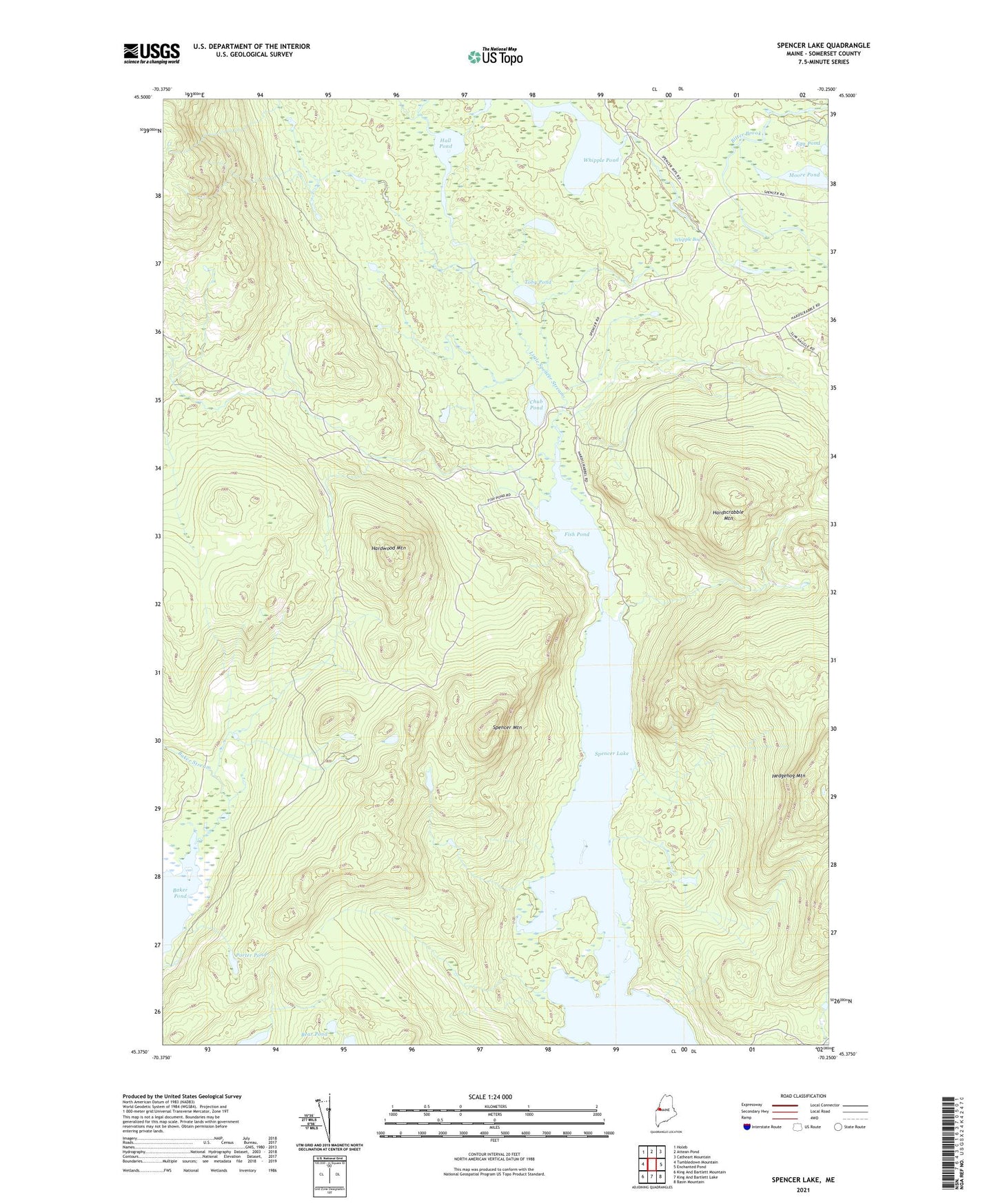
2024 topographic map quadrangle Spencer Lake in the state of Maine. Scale: 1:24000. Based on the newly updated USGS 7.5' US Topo map series, this map is in the following counties: Somerset. The map contains contour data, water features, and other items you are used to seeing on USGS maps, but also has updated roads and other features. This is the next generation of topographic maps. Printed on high-quality waterproof paper with UV fade-resistant inks.
Quads adjacent to this one:
West: Tumbledown Mountain
Northwest: Holeb
North: Attean Pond
Northeast: Catheart Mountain
East: Enchanted Pond
Southeast: Basin Mountain
South: King And Bartlett Lake
Southwest: King And Bartlett Mountain
This map covers the same area as the classic USGS quad with code o45070d3.
Contains the following named places: Baker Pond, Bear Pond, Chub Pond, Egg Pond, Fish Pond, Hall Pond, Hardscrabble Mountain, Hardwood Mountain, Hedgehog Mountain, Hobbstown Depot Camp, Hobbstown Township, Moore Pond, Porter Pond, Spencer Lake, Spencer Lake Camps, Spencer Mountain, Toby Pond, Unorganized Territory of Northwest Somerset, Whipple Bog, Whipple Pond