MyTopo
Bois Bubert Maine US Topo Map
Couldn't load pickup availability
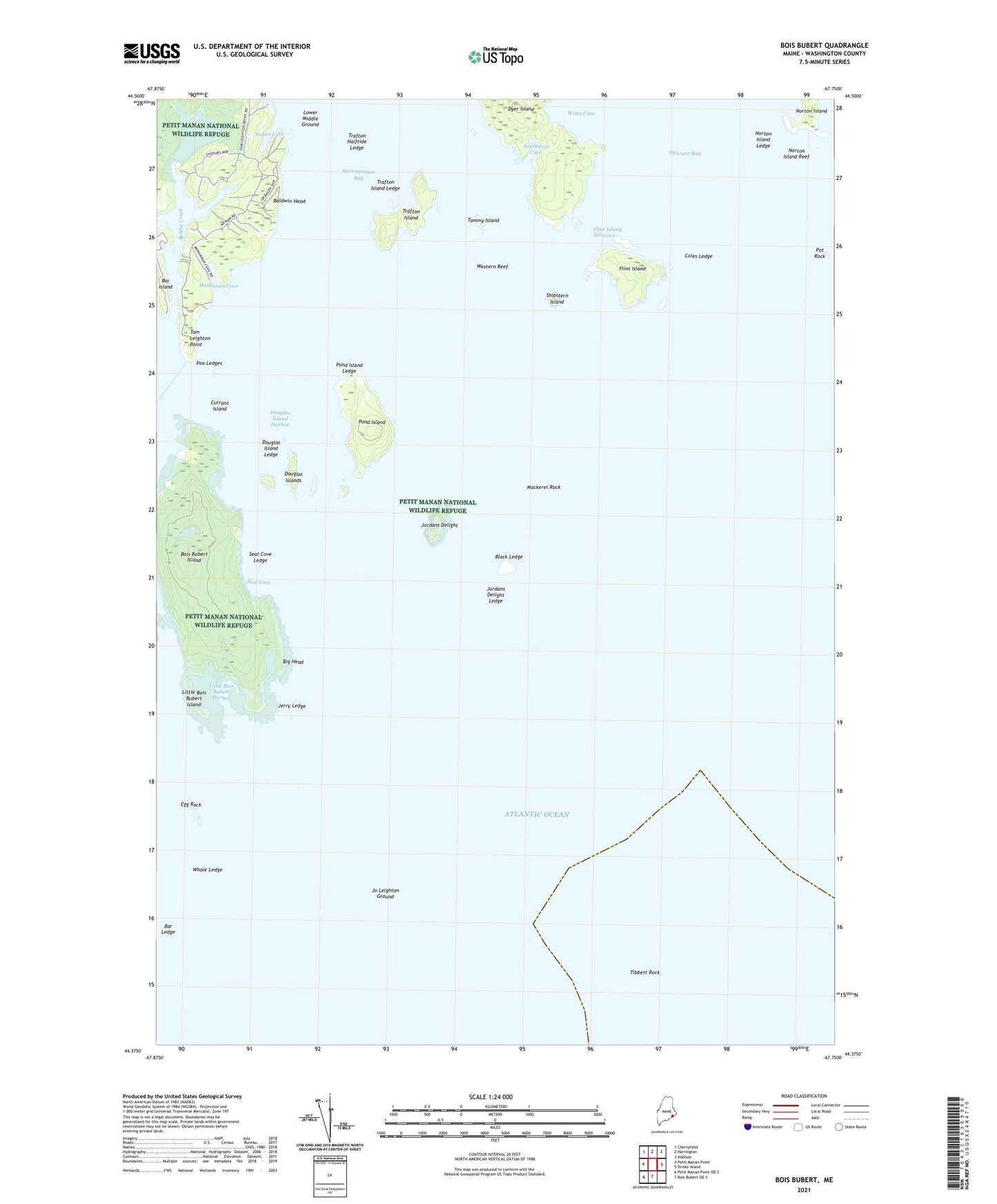
2024 topographic map quadrangle Bois Bubert in the state of Maine. Scale: 1:24000. Based on the newly updated USGS 7.5' US Topo map series, this map is in the following counties: Washington. The map contains contour data, water features, and other items you are used to seeing on USGS maps, but also has updated roads and other features. This is the next generation of topographic maps. Printed on high-quality waterproof paper with UV fade-resistant inks.
Quads adjacent to this one:
West: Petit Manan Point
Northwest: Cherryfield
North: Harrington
Northeast: Addison
East: Drisko Island
South: Bois Bubert OE S
Southwest: Petit Manan Point OE S
This map covers the same area as the classic USGS quad with code o44067d7.
Contains the following named places: Baldwin Head, Bar Ledge, Big Head, Black Ledge, Bois Bubert Island, Coles Ledge, Currant Island, Douglas Island Harbor, Douglas Island Ledge, Douglas Islands, Dyer Island, Egg Rock, Flint Island, Flint Island Narrows, Jerry Ledge, Jo Leighton Ground, Jordans Delight, Jordans Delight Ledge, Little Bois Bubert Harbor, Little Bois Bubert Island, Lower Middle Ground, Mackerel Rock, Monhonan Cove, Narraguagus Light Station, Norton Island, Norton Island Ledge, Norton Island Reef, Pea Ledges, Pond Island, Pond Island Ledge, Pot Rock, Seal Cove, Seal Cove Ledge, Shipstern Island, Southwest Cove, Stover Cove, Tibbett Rock, Tom Leighton Point, Tommy Island, Town of Milbridge, Trafton Halftide Beacon, Trafton Halftide Ledge, Trafton Island, Trafton Island Ledge, Watts Cove, Western Reef, Whale Ledge