MyTopo
Moosehead Maine US Topo Map
Couldn't load pickup availability
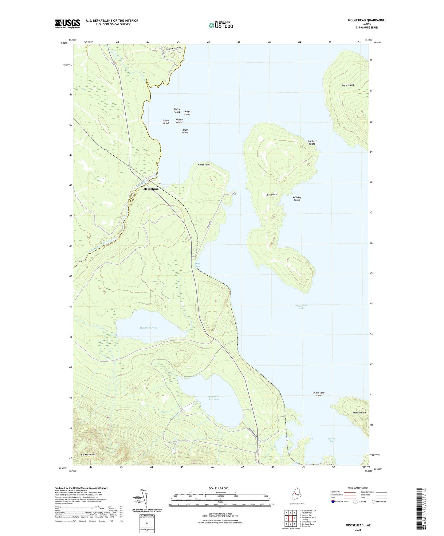
2024 topographic map quadrangle Moosehead in the state of Maine. Scale: 1:24000. Based on the newly updated USGS 7.5' US Topo map series, this map is in the following counties: Piscataquis, Somerset. The map contains contour data, water features, and other items you are used to seeing on USGS maps, but also has updated roads and other features. This is the next generation of topographic maps. Printed on high-quality waterproof paper with UV fade-resistant inks.
Quads adjacent to this one:
West: Indian Pond North
Northwest: Brassua Lake East
North: Mount Kineo
Northeast: Spencer Bay
East: Lily Bay
Southeast: Greenville
South: Big Moose Pond
Southwest: Indian Pond South
This map covers the same area as the classic USGS quad with code o45069e6.
Contains the following named places: Big Moose Township, Black Island, Black Sand Island, Burnham Pond, Deep Cove, Deer Island, East Outlet Dam, Forsythe Brook, Green Island, Lambert Island, Ledge Island, Moose Bay, Moose Brook, Moose Island, Moose Point, Moosehead, Moosehead Lake, Mountain View Pond, Sibley Island, Snake Island, Upper Moose Brook, Whiskey Island