MyTopo
Catheart Mountain Maine US Topo Map
Couldn't load pickup availability
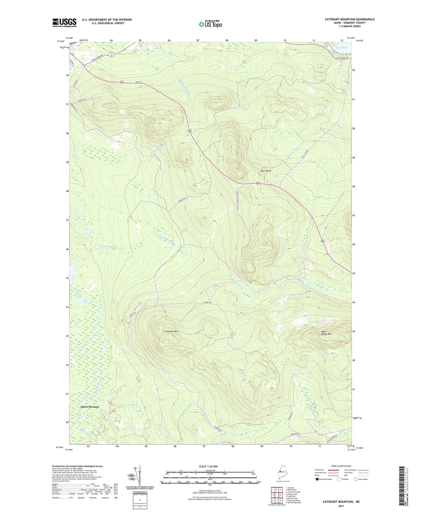
2021 topographic map quadrangle Catheart Mountain in the state of Maine. Scale: 1:24000. Based on the newly updated USGS 7.5' US Topo map series, this map is in the following counties: Somerset. The map contains contour data, water features, and other items you are used to seeing on USGS maps, but also has updated roads and other features. This is the next generation of topographic maps. Printed on high-quality waterproof paper with UV fade-resistant inks.
Quads adjacent to this one:
West: Attean Pond
Northwest: Jackman
North: Heald Pond
Northeast: Churchill Stream
East: Long Pond
Southeast: Johnson Mountain
South: Enchanted Pond
Southwest: Spencer Lake
Contains the following named places: Attean Falls, Bean Brook Mountain, Bradstreet Township, Catheart Mountain, Fourmile Brook, Horse Brook, Jackman Area Volunteer Ambulance Service, Jackman Field, Johns Camping Area, Owls Head, Saint Anthonys Church, Sally Mountain Trail, Three Streams, Town of Jackman