MyTopo
Columbia Falls Maine US Topo Map
Couldn't load pickup availability
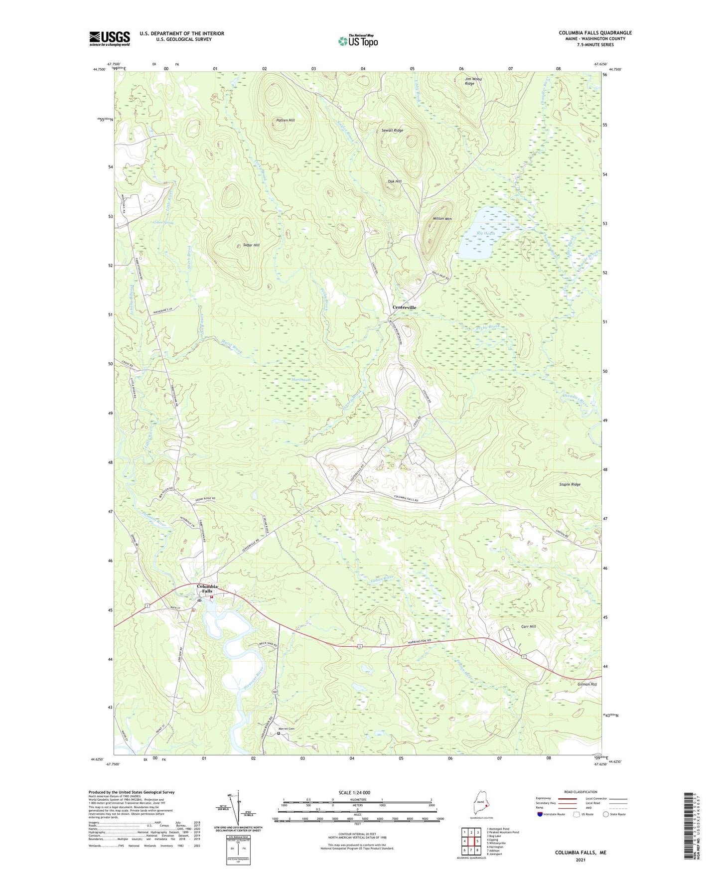
2024 topographic map quadrangle Columbia Falls in the state of Maine. Scale: 1:24000. Based on the newly updated USGS 7.5' US Topo map series, this map is in the following counties: Washington. The map contains contour data, water features, and other items you are used to seeing on USGS maps, but also has updated roads and other features. This is the next generation of topographic maps. Printed on high-quality waterproof paper with UV fade-resistant inks.
Quads adjacent to this one:
West: Epping
Northwest: Montegail Pond
North: Peaked Mountain Pond
Northeast: Bog Lake
East: Whitneyville
Southeast: Jonesport
South: Addison
Southwest: Harrington
This map covers the same area as the classic USGS quad with code o44067f6.
Contains the following named places: Alder Brook, Big Heath, Carr Hill, Centerville, Central District, Columbia Falls, Columbia Falls Elementary School, Columbia Falls Post Office, Columbia Falls Volunteer Fire Department, East Branch Chandler River, Green Spring, Jim Wood Ridge, Johnny B Brook, Jonesboro Station, Kaylor Brook, Libby Brook, Little River, Marst Brook, Marst Heath, Merritt Cemetery, Milton Mountain, Oak Hill, Patten Hill, Pecky Brook, Ruggles House Museum, Samade Brook, Sewall Ridge, Sherb Brook, Staple Ridge, Sugar Hill, Tenney Brook, Town of Columbia Falls, ZIP Code: 04623