MyTopo
Epping Maine US Topo Map
Couldn't load pickup availability
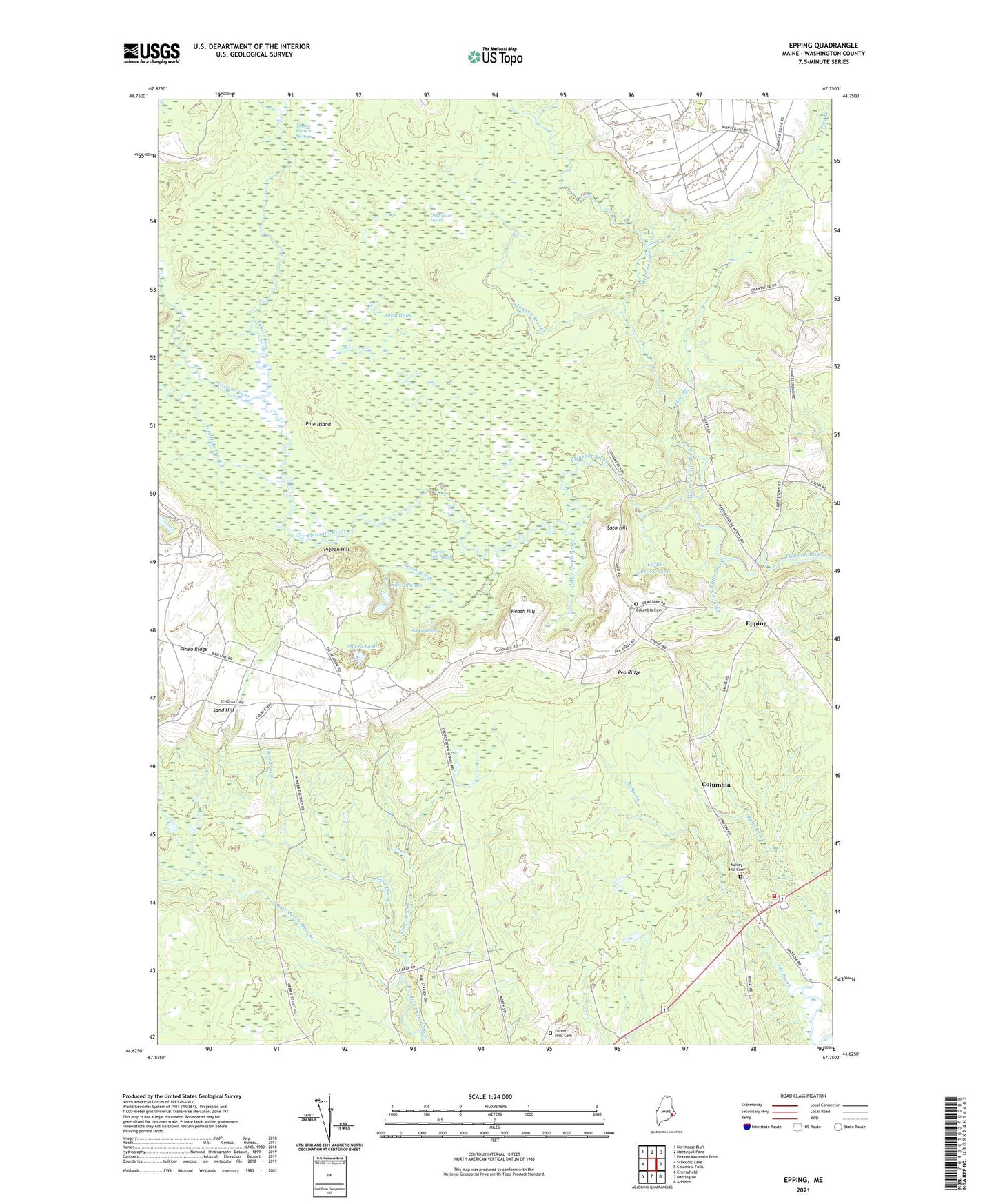
2024 topographic map quadrangle Epping in the state of Maine. Scale: 1:24000. Based on the newly updated USGS 7.5' US Topo map series, this map is in the following counties: Washington. The map contains contour data, water features, and other items you are used to seeing on USGS maps, but also has updated roads and other features. This is the next generation of topographic maps. Printed on high-quality waterproof paper with UV fade-resistant inks.
Quads adjacent to this one:
West: Schoodic Lake
Northwest: Northeast Bluff
North: Montegail Pond
Northeast: Peaked Mountain Pond
East: Columbia Falls
Southeast: Addison
South: Harrington
Southwest: Cherryfield
This map covers the same area as the classic USGS quad with code o44067f7.
Contains the following named places: Bells Brook, Branch Brook, Coffin Brook Pond, Columbia, Columbia Cemetery, Deep Cove Heath, Dog Pit Brook, Dorr Brook, Epping, Epping Volunteer Fire District, Flanders Little Brook, Forest Hills Cemetery, Georgetown, Great Heath, Great Marsh Stream, Hay Branch, Heath Brook, Heath Hill, Jacks Spring, Little Heath Brook, Little River Church, Little River Corner, Mailey Hill Cemetery, Mud Hole Brook, Myers Ponds, Pea Ridge, Pigeon Hill, Pigeon Hill Heath, Pine Island, Pineo Ridge, Pleasant River Ambulance, Saco Hill, Sand Hill, Silica Ponds, Taylor Branch Swamp, Tibbettstown, Town of Columbia, Trout Brook, Western Little River