MyTopo
Peaked Mountain Pond Maine US Topo Map
Couldn't load pickup availability
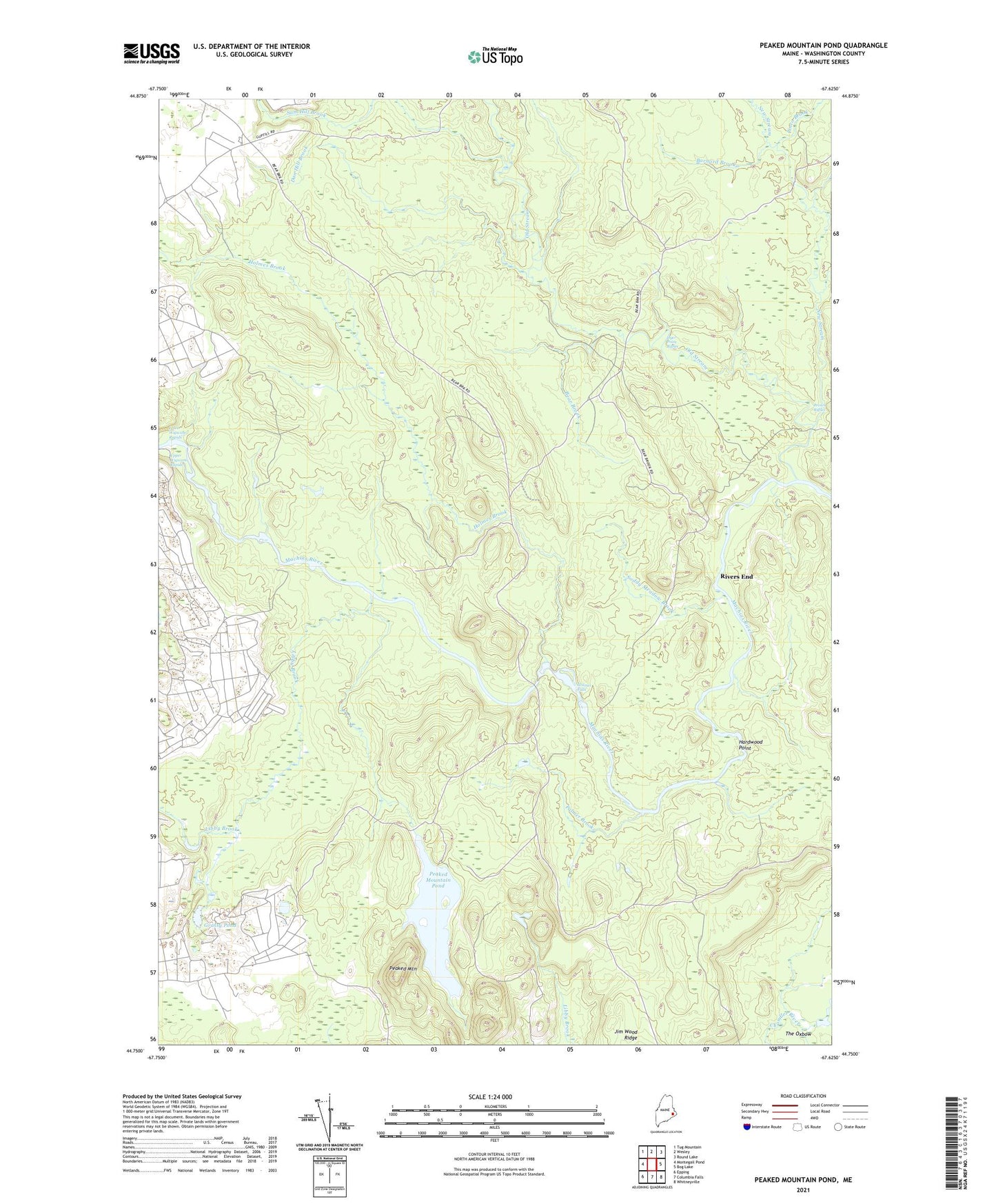
2024 topographic map quadrangle Peaked Mountain Pond in the state of Maine. Scale: 1:24000. Based on the newly updated USGS 7.5' US Topo map series, this map is in the following counties: Washington. The map contains contour data, water features, and other items you are used to seeing on USGS maps, but also has updated roads and other features. This is the next generation of topographic maps. Printed on high-quality waterproof paper with UV fade-resistant inks.
Quads adjacent to this one:
West: Montegail Pond
Northwest: Tug Mountain
North: Wesley
Northeast: Round Lake
East: Bog Lake
Southeast: Whitneyville
South: Columbia Falls
Southwest: Epping
This map covers the same area as the classic USGS quad with code o44067g6.
Contains the following named places: Barnard Brook, Bear Brook, Bog Stream, Brown Riffles, Dan Hill Brook, Dyer Point Riffles, Grassy Pond, Hardwood Point, Holmes Brook, Holmes Falls, Joe Meadow Brook, Libby Brook, Lower Wigwam Rapids, Mattimo Place, New Stream, Old Stream, Palmer Brook, Peaked Mountain, Peaked Mountain Pond, Pineo Brook, Rivers End, Sam Hill Brook, Soddy Meadow Brook, The Oxbow