MyTopo
Damariscotta Maine US Topo Map
Couldn't load pickup availability
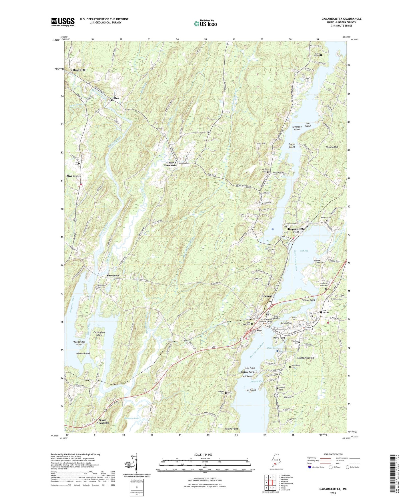
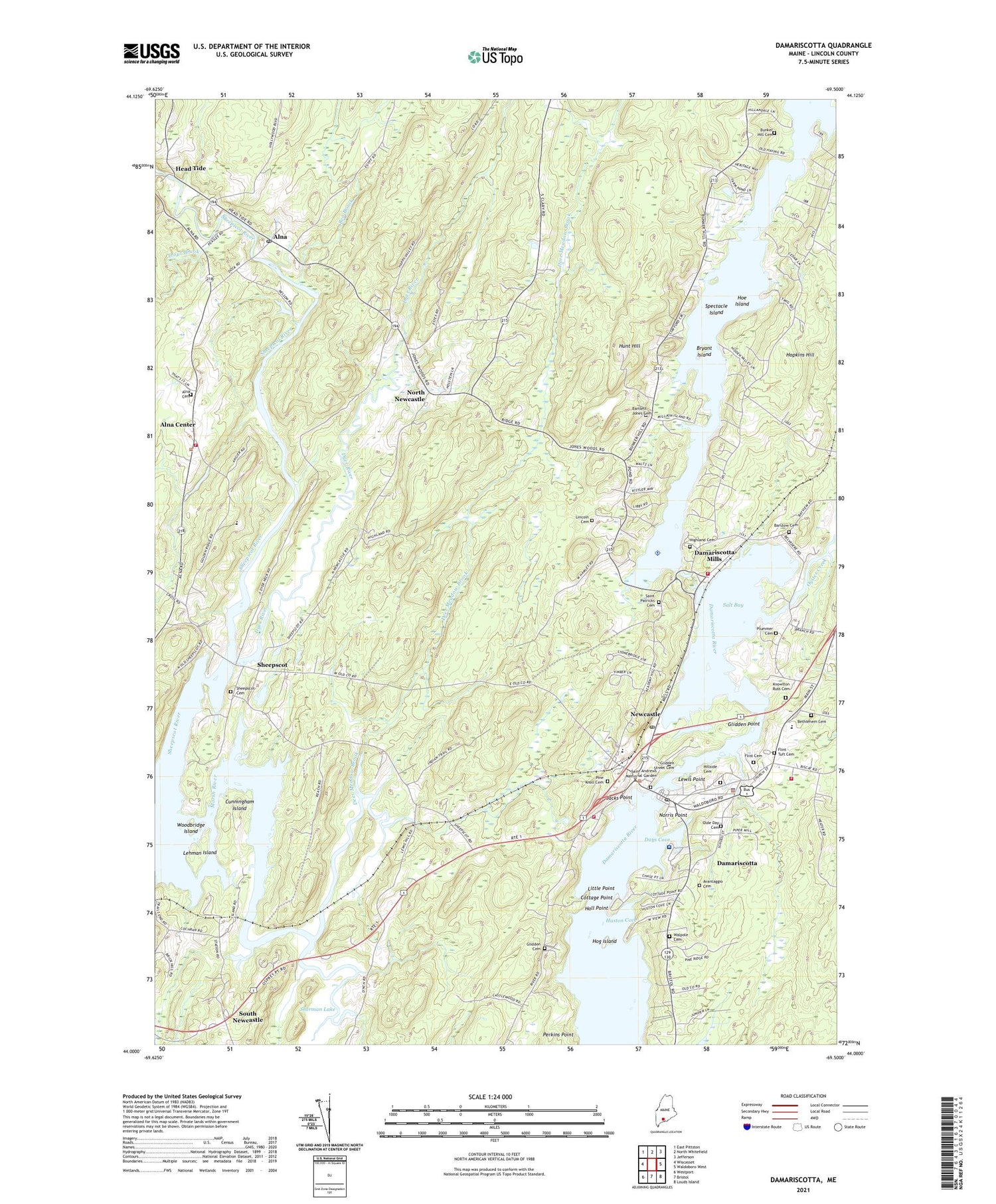
2021 topographic map quadrangle Damariscotta in the state of Maine. Scale: 1:24000. Based on the newly updated USGS 7.5' US Topo map series, this map is in the following counties: Lincoln. The map contains contour data, water features, and other items you are used to seeing on USGS maps, but also has updated roads and other features. This is the next generation of topographic maps. Printed on high-quality waterproof paper with UV fade-resistant inks.
Quads adjacent to this one:
West: Wiscasset
Northwest: East Pittston
North: North Whitefield
Northeast: Jefferson
East: Waldoboro West
Southeast: Louds Island
South: Bristol
Southwest: Westport
Contains the following named places: Alna, Alna Cemetery, Alna Center, Alna Historical Society Building, Alna Meetinghouse, Alna Post Office, Alna Volunteer Fire Department, American Legion Hall, Barstow Cemetery, Ben Brook, Bethlehem Cemetery, Bryant Island, Castner School, Central Lincoln County Ambulance Service, Central Lincoln County YMCA Building, Chapman-Hall House Museum, Cottage Point, Cunningham Island, Damariscotta, Damariscotta Baptist Church, Damariscotta Census Designated Place, Damariscotta Fire Department, Damariscotta Information Bureau, Damariscotta Lake Dam, Damariscotta Mills, Damariscotta Police Department, Damariscotta Post Office, Damariscotta Region Chamber of Commerce, Damariscotta-Newcastle Census Designated Place, Days Cove, Deer Meadow Brook, Dyer River, Faith Baptist Church of Damariscotta, Glidden Cemetery, Glidden Point, Great Salt Bay Community School, Hall Point, Head Tide, Head Tide Church, Head Tide Dam, Head Tide Historic District, Hillside Cemetery, Hoe Island, Hog Island, Hopkins Hill, Hunt Hill, Huston Cove, Jacks Point, Lehman Island, Lewis Point, Lincoln Academy, Lincoln Cemetery, Lincoln Health - Miles Campus and Hospital, Lincoln Theatre, Little Point, Lonna Bunting Childrens Playground, Main Street Historic District, Marsh Bridge Dam, Marsh River, Miles Memorial Hospital Medical Library, Newcastle, Newcastle Alna Baptist Church, Newcastle Census Designated Place, Newcastle Fire Company, Newcastle Post Office, Nobleboro Volunteer Fire Station Mills, Norris Point, North Newcastle, Oyster Creek, Perkins Point, Pine Knoll Cemetery, Saint Andrews Episcopal Church, Saint Patricks Cemetery, Saint Patricks Church, Saint Patricks Parish Center, Salt Bay, Second Congregational Church, Sheepscot, Sheepscot Cemetery, Sheepscot Historic District, Sheepscot River Reservoir, Sherman Lake, Sherman Lake View Campground, Skidompha Public Library, South Newcastle, Spectacle Island, Town of Newcastle, Trout Brook, Walpole Cemetery, WCME-FM (Boothbay Harbor), Woodbridge Island, ZIP Code: 04553