MyTopo
Danforth Maine US Topo Map
Couldn't load pickup availability
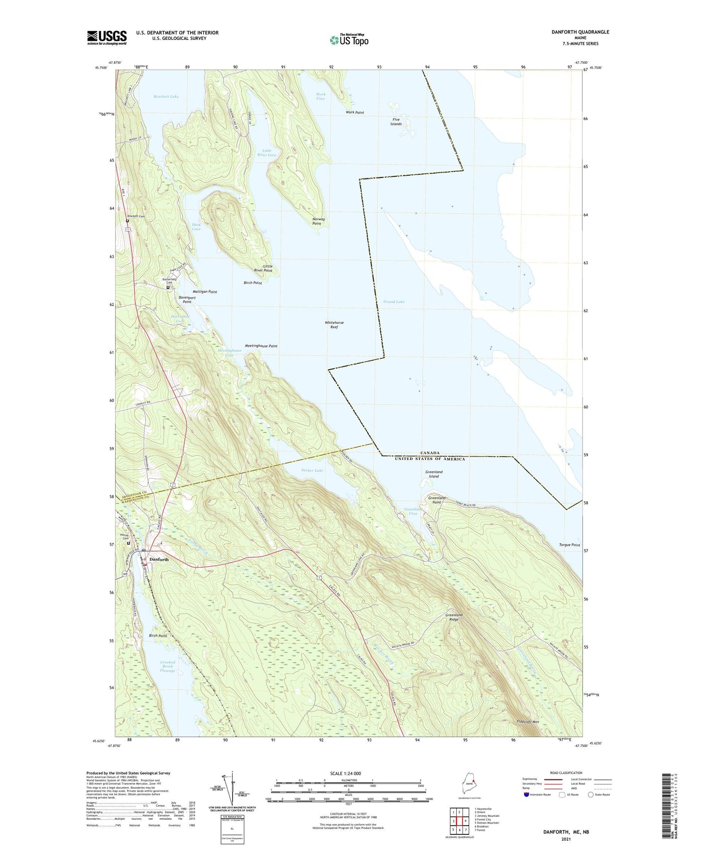
2024 topographic map quadrangle Danforth in the state of Maine. Scale: 1:24000. Based on the newly updated USGS 7.5' US Topo map series, this map is in the following counties: Washington, Aroostook. The map contains contour data, water features, and other items you are used to seeing on USGS maps, but also has updated roads and other features. This is the next generation of topographic maps. Printed on high-quality waterproof paper with UV fade-resistant inks.
Quads adjacent to this one:
West: Jimmey Mountain
Northwest: Haynesville
North: Orient
East: Forest City
Southeast: Forest
South: Brookton
Southwest: Stetson Mountain
This map covers the same area as the classic USGS quad with code o45067f7.
Contains the following named places: Birch Point, Brackett Cemetery, Brackett Lake, Butterfield Cemetery, Butterfield Landing, Crooked Brook Dam, Crooked Brook Flowage, Danforth, Danforth Baptist Church, Danforth Census Designated Place, Danforth Post Office, Danforth Public Library, Danforth Volunteer Fire Department, Dark Cove, Davenport Cove, Davenport Point, East Grand School, Five Islands, Grand Lake, Grand Lake Grange, Greenland Brook, Greenland Cove, Greenland Island, Greenland Point, Greenland Ridge, Hilltop Cemetery, Little River Cove, Little River Point, Mattigan Point, Meetinghouse Cove, Meetinghouse Point, Northern Washington Southern Aroostook Regional Ambulance, Norway Point, Sandy Brook, Sucker Lake, Town of Danforth, Town of Weston, Two Mile Curve, Union Hall, Whitehorse Reef, Work Cove, Work Point