MyTopo
Jimmey Mountain Maine US Topo Map
Couldn't load pickup availability
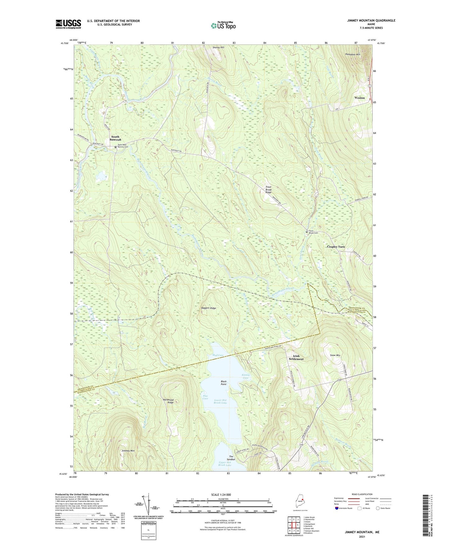
2024 topographic map quadrangle Jimmey Mountain in the state of Maine. Scale: 1:24000. Based on the newly updated USGS 7.5' US Topo map series, this map is in the following counties: Aroostook, Washington. The map contains contour data, water features, and other items you are used to seeing on USGS maps, but also has updated roads and other features. This is the next generation of topographic maps. Printed on high-quality waterproof paper with UV fade-resistant inks.
Quads adjacent to this one:
West: Wytopitlock
Northwest: Alder Brook
North: Haynesville
Northeast: Orient
East: Danforth
Southeast: Brookton
South: Stetson Mountain
Southwest: Potter Hill
This map covers the same area as the classic USGS quad with code o45067f8.
Contains the following named places: Baldwin Brook, Baskahegan Stream, Battle Brook, Black Point, Bonner School, Cropley Turn, Daggett Ridge, Dingey Pond, Hardwood Ridge, Hot Brook, Irish Settlement, Jimmey Mountain, Kinney Cove, Little Battle Brook, Lower Hot Brook Lake, Mud Cove, Peekaboo Mountain, Pine Cove, Russell Camp, Shorey Brook, Shorey Hill, Snow Mountain, South Bancroft, The Sandbar, Toole Bean Spinney Cemetery, Town of Bancroft, Trout Brook, Trout Brook Cemetery, Trout Brook Ridge, Unorganized Territory of Bancroft, Weston, Weston Community Church, ZIP Code: 04424