MyTopo
Forest Maine US Topo Map
Couldn't load pickup availability
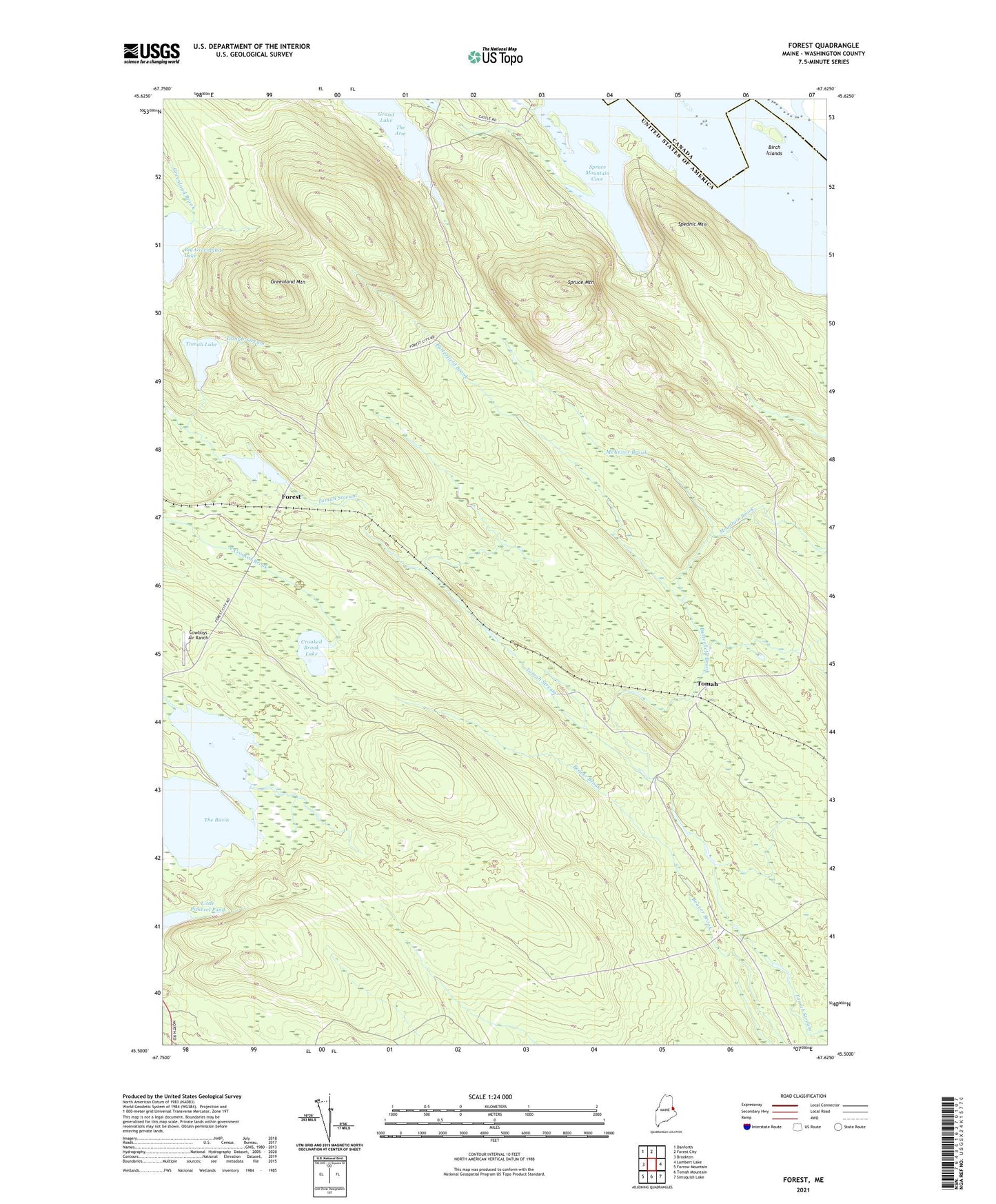
2024 topographic map quadrangle Forest in the state of Maine. Scale: 1:24000. Based on the newly updated USGS 7.5' US Topo map series, this map is in the following counties: Washington. The map contains contour data, water features, and other items you are used to seeing on USGS maps, but also has updated roads and other features. This is the next generation of topographic maps. Printed on high-quality waterproof paper with UV fade-resistant inks.
Quads adjacent to this one:
West: Brookton
Northwest: Danforth
North: Forest City
East: Lambert Lake
Southeast: Simsquish Lake
South: Tomah Mountain
Southwest: Farrow Mountain
This map covers the same area as the classic USGS quad with code o45067e6.
Contains the following named places: Big Greenland Lake, Birch Islands, Butterfield Brook, Cowboys Air Ranch, Crooked Brook Lake, Drake Lake, Forest, Forest Township, Greenland Mountain, Jackson Brook Lake, Little Pickerel Pond, McKever Brook, Mountain Brook, Spednic Mountain, Spruce Mountain, Spruce Mountain Cove, The Basin, Tomah, Tomah Lake