MyTopo
Brookton Maine US Topo Map
Couldn't load pickup availability
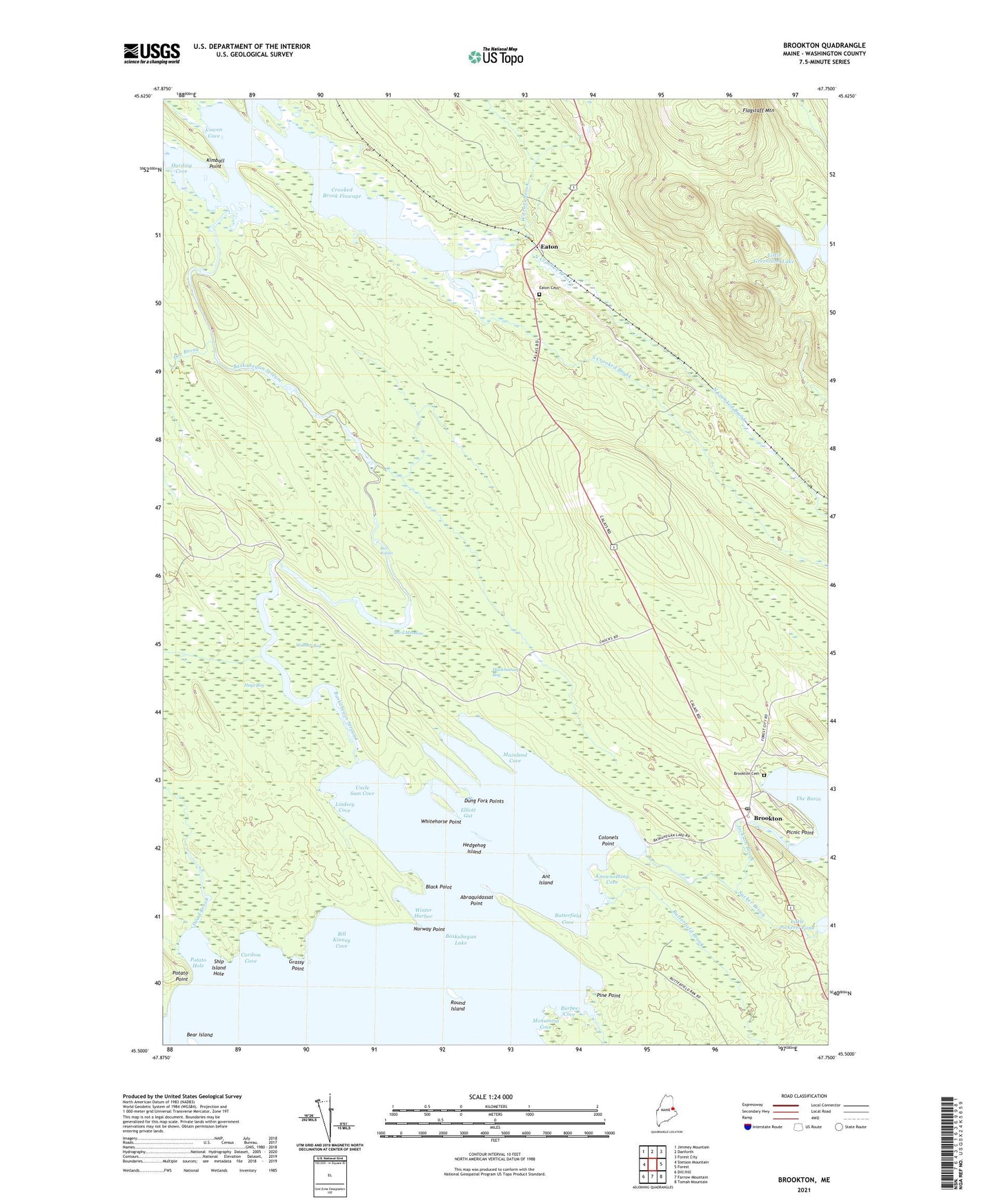
2024 topographic map quadrangle Brookton in the state of Maine. Scale: 1:24000. Based on the newly updated USGS 7.5' US Topo map series, this map is in the following counties: Washington. The map contains contour data, water features, and other items you are used to seeing on USGS maps, but also has updated roads and other features. This is the next generation of topographic maps. Printed on high-quality waterproof paper with UV fade-resistant inks.
Quads adjacent to this one:
West: Stetson Mountain
Northwest: Jimmey Mountain
North: Danforth
Northeast: Forest City
East: Forest
Southeast: Tomah Mountain
South: Farrow Mountain
Southwest: Dill Hill
This map covers the same area as the classic USGS quad with code o45067e7.
Contains the following named places: Abraquidassat Point, Ant Island, Anvil Meadow, Baskahegan Lake, Bear Island, Bill Kinney Cove, Black Point, Brookton, Brookton Cemetery, Brookton Post Office, Burbee Brook, Burbee Cove, Butterfield Brook, Butterfield Cove, Caribou Cove, Colonels Point, Cowen Cove, Crooked Brook Flowage, Dead Brook, Doe Brook, Dung Fork Points, Eaton, Eaton Cemetery, Elliott Gut, Flagstaff Mountain, Grassy Point, Hackmatack Bog, Harding Cove, Hays Bog, Hedgehog Island, Hell Rapids, Huff Camp, Jackson Brook, Kimball Point, Kinney Nation, Knownothing Cove, Lincoln School, Lindsey Cove, Little Greenland Lake, Mainland Cove, Monument Cove, North Crooked Brook, Norway Point, Picnic Point, Pine Point, Potato Hole, Potato Point, Round Island, Ship Island Hole, South Crooked Brook, Sucker Brook, Uncle Sam Cove, Webber Bog, Whitehorse Point, Winter Harbor, Witcher Brook, ZIP Code: 04413