MyTopo
Dimmick Mountain Maine US Topo Map
Couldn't load pickup availability
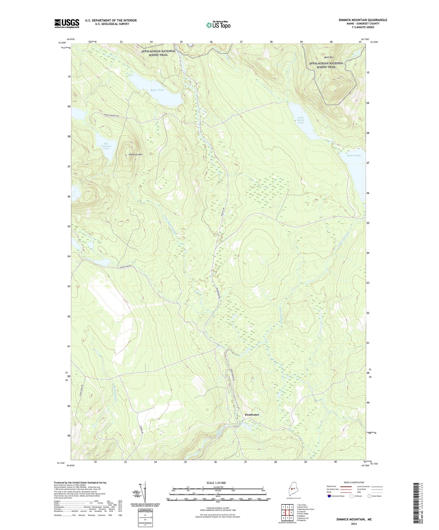
2021 topographic map quadrangle Dimmick Mountain in the state of Maine. Scale: 1:24000. Based on the newly updated USGS 7.5' US Topo map series, this map is in the following counties: Somerset. The map contains contour data, water features, and other items you are used to seeing on USGS maps, but also has updated roads and other features. This is the next generation of topographic maps. Printed on high-quality waterproof paper with UV fade-resistant inks.
Quads adjacent to this one:
West: Caratunk
Northwest: The Forks
North: Moxie Pond
Northeast: Bald Mountain Pond
East: Foster Ridge
Southeast: Kingsbury
South: Mahoney Hill
Southwest: Bingham
Contains the following named places: Austin Stream Falls, Baker Pond, Baker Stream, Bald Mountain Station, Bald Mountain Township T2 R3, Big Dimmick Pond, Deadwater, Dimmick Mountain, Dimmick Stream, Heald Stream, Little Austin Pond, Little Dimmick Pond, Little Heald Brook, Mountain Dimmick Pond, Moxie Bog, Rift Brook, South Branch Austin Stream, Wild Brook, ZIP Code: 04920