MyTopo
Gardner Pond Maine US Topo Map
Couldn't load pickup availability
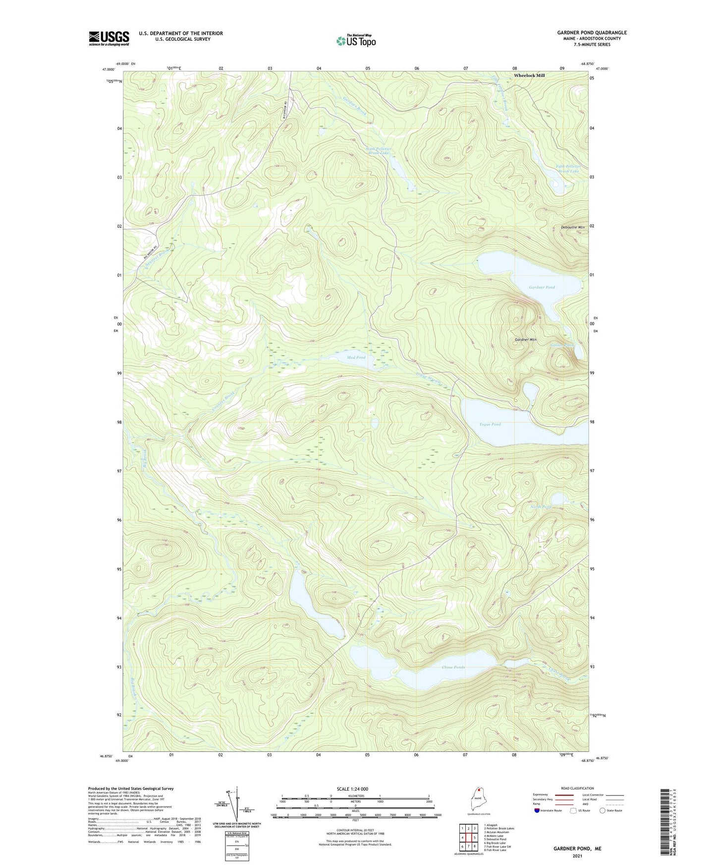
2024 topographic map quadrangle Gardner Pond in the state of Maine. Scale: 1:24000. Based on the newly updated USGS 7.5' US Topo map series, this map is in the following counties: Aroostook. The map contains contour data, water features, and other items you are used to seeing on USGS maps, but also has updated roads and other features. This is the next generation of topographic maps. Printed on high-quality waterproof paper with UV fade-resistant inks.
Quads adjacent to this one:
West: McKeen Lake
Northwest: Allagash
North: Pelletier Brook Lakes
Northeast: McLean Mountain
East: Deboullie Pond
Southeast: Fish River Lake
South: Fish River Lake SW
Southwest: Big Brook Lake
This map covers the same area as the classic USGS quad with code o46068h8.
Contains the following named places: Beaver Tail Pond, Chase Ponds, Conners Brook, Deboullie Mountain, Fifth Pelletier Brook Lake, Galilee Pond, Gardner Mountain, Gardner Pond, Mud Pond, North Pond, Sixth Pelletier Brook Lake, T14 R9 WELS, T15 R9 WELS, Togue Pond, Togue Stream, Wheelock Mill