MyTopo
Pelletier Brook Lakes Maine US Topo Map
Couldn't load pickup availability
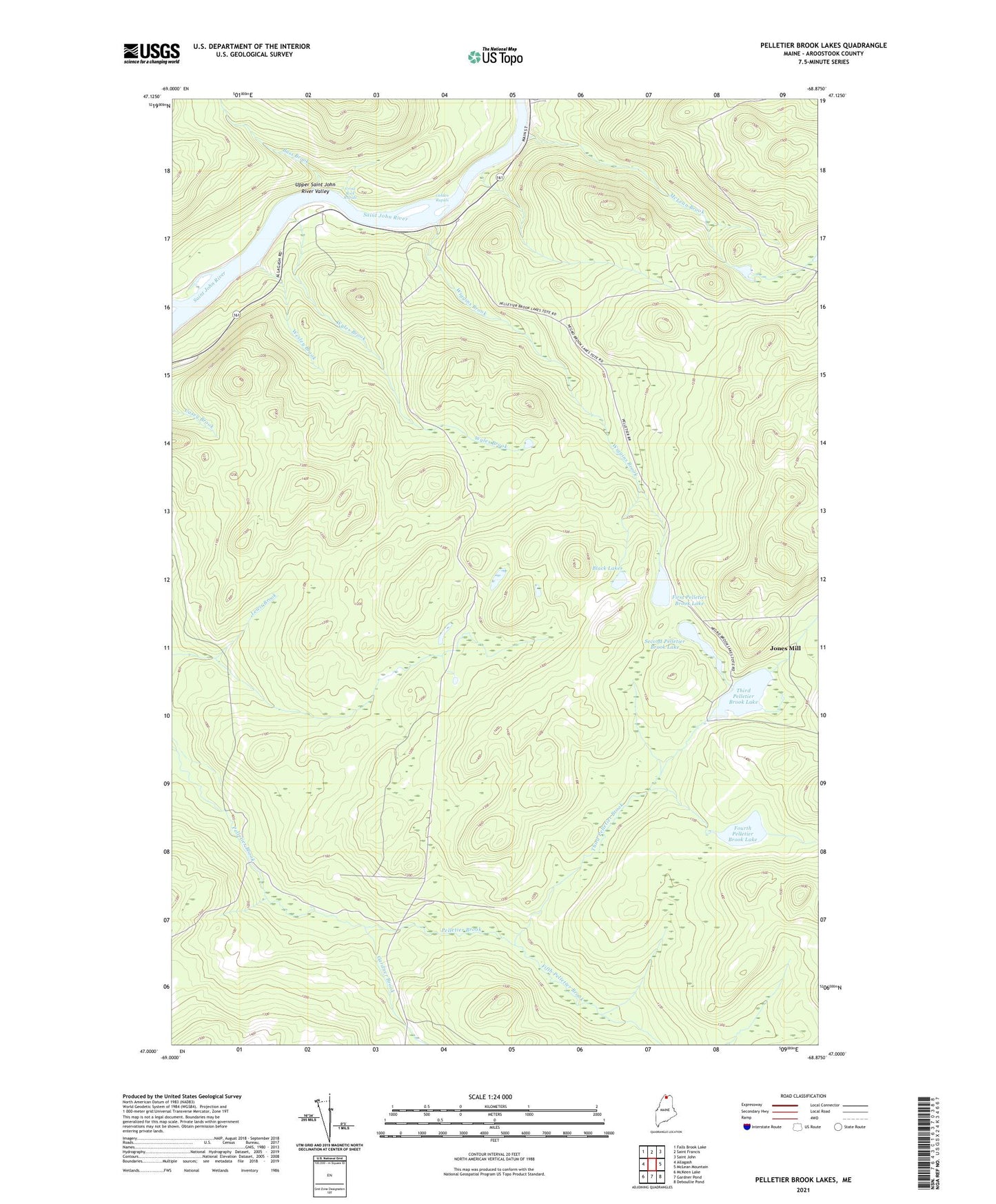
2024 topographic map quadrangle Pelletier Brook Lakes in the state of Maine. Scale: 1:24000. Based on the newly updated USGS 7.5' US Topo map series, this map is in the following counties: Aroostook. The map contains contour data, water features, and other items you are used to seeing on USGS maps, but also has updated roads and other features. This is the next generation of topographic maps. Printed on high-quality waterproof paper with UV fade-resistant inks.
Quads adjacent to this one:
West: Allagash
Northwest: Falls Brook Lake
North: Saint Francis
Northeast: Saint John
East: McLean Mountain
Southeast: Deboullie Pond
South: Gardner Pond
Southwest: McKeen Lake
This map covers the same area as the classic USGS quad with code o47068a8.
Contains the following named places: Bass Brook, Black Lake, Cross Rock, Cross Rock Rapids, Cross Rock School, Fifth Pelletier Brook, First Pelletier Brook Lake, Fourth Pelletier Brook Lake, Gardner Brook, Golden Rapids, Jones Camp, McLean Brook, Pelletier Brook Lakes, Second Pelletier Brook Lake, Soucier Camp, T16 R9 WELS, Third Pelletier Brook, Third Pelletier Brook Lake, Wesley Brook, Wiggins Brook, Wyles Brook