MyTopo
Gassabias Lake Maine US Topo Map
Couldn't load pickup availability
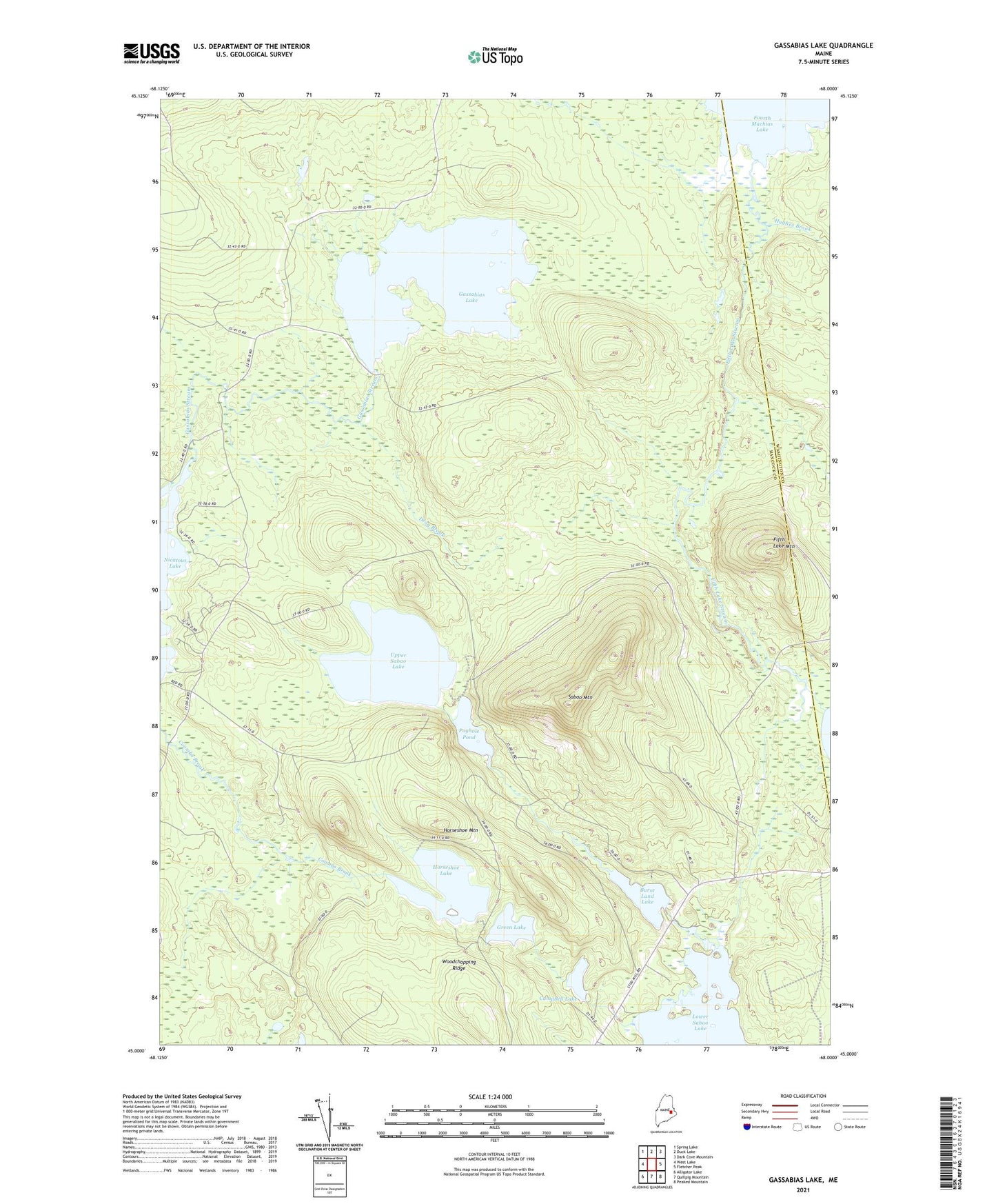
2024 topographic map quadrangle Gassabias Lake in the state of Maine. Scale: 1:24000. Based on the newly updated USGS 7.5' US Topo map series, this map is in the following counties: Hancock, Washington. The map contains contour data, water features, and other items you are used to seeing on USGS maps, but also has updated roads and other features. This is the next generation of topographic maps. Printed on high-quality waterproof paper with UV fade-resistant inks.
Quads adjacent to this one:
West: West Lake
Northwest: Spring Lake
North: Duck Lake
Northeast: Dark Cove Mountain
East: Fletcher Peak
Southeast: Peaked Mountain
South: Quillpig Mountain
Southwest: Alligator Lake
This map covers the same area as the classic USGS quad with code o45068a1.
Contains the following named places: Burnt Land Lake, Campbell Lake, Drag Brook, Fifth Lake Mountain, Fifth Lake Stream, Gassabias Lake, Gassabias Stream, Green Lake, Horseshoe Lake, Horseshoe Mountain, Knight Dam, Pughole Pond, Sabao Mountain, T41 MD BPP, Upper Sabao Lake, Woodchopping Ridge