MyTopo
West Lake Maine US Topo Map
Couldn't load pickup availability
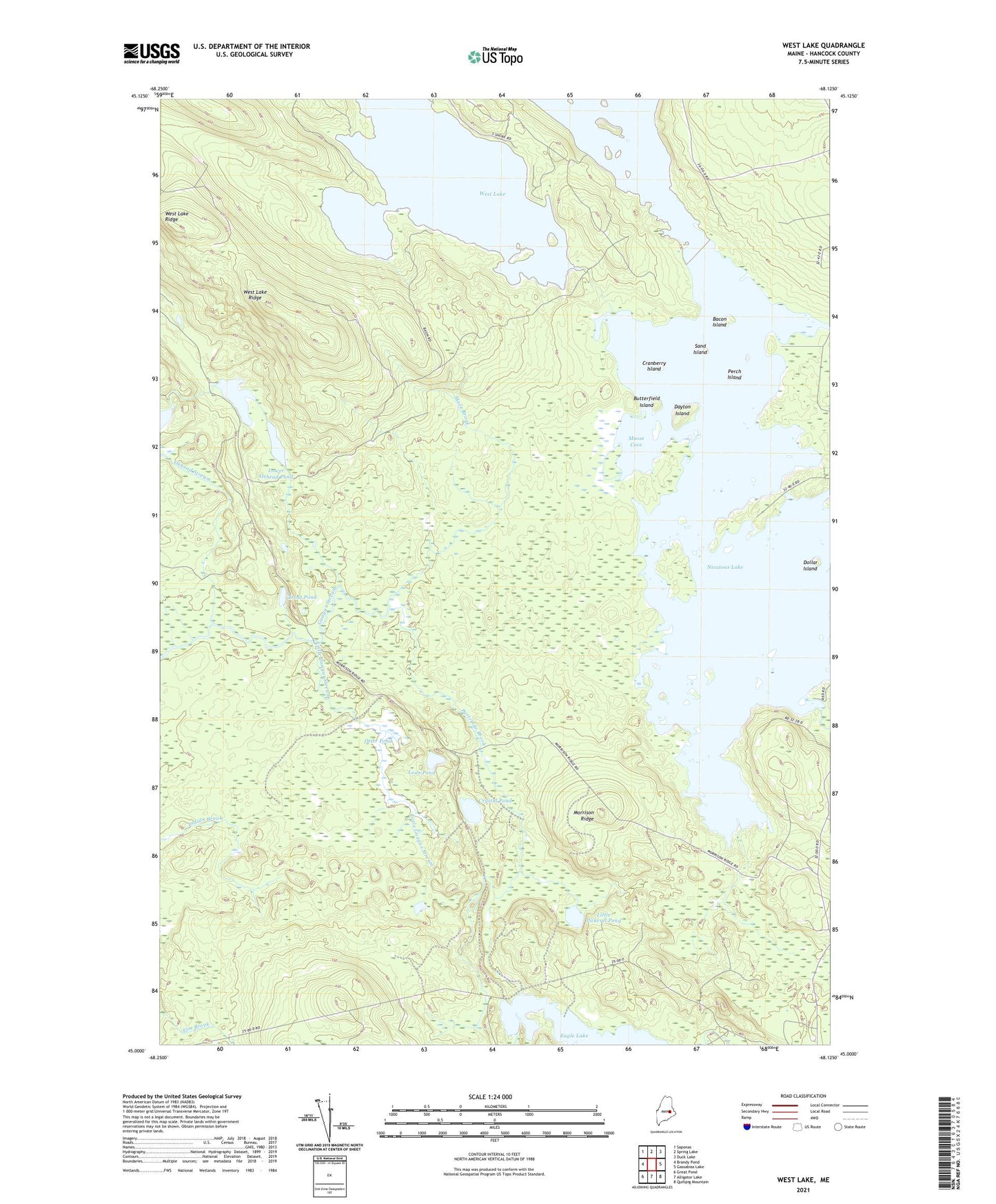
2024 topographic map quadrangle West Lake in the state of Maine. Scale: 1:24000. Based on the newly updated USGS 7.5' US Topo map series, this map is in the following counties: Hancock. The map contains contour data, water features, and other items you are used to seeing on USGS maps, but also has updated roads and other features. This is the next generation of topographic maps. Printed on high-quality waterproof paper with UV fade-resistant inks.
Quads adjacent to this one:
West: Brandy Pond
Northwest: Saponac
North: Spring Lake
Northeast: Duck Lake
East: Gassabias Lake
Southeast: Quillpig Mountain
South: Alligator Lake
Southwest: Great Pond
This map covers the same area as the classic USGS quad with code o45068a2.
Contains the following named places: Abamgamook Lake, Bacon Island, Butterfield Island, Coombs Brook, Cranberry Island, Crystal Pond, Dayton Island, Dollar Island, Eagle Brook, Eagle Lake, Eagle Lake Trail, Little Guagus Stream, Little Pickerel Pond, Loon Pond, Lower Oxhead Pond, Mace Brook, Middle Oxhead Pond, Moose Cove, Morrison Ridge, Nicatous Club, Nicatous Lake, Otter Pond, Oxhead Stream, Partridge Brook, Perch Island, Sand Island, T40 MD BPP, Trout Pond, West Lake, West Lake Ridge