MyTopo
Peaked Mountain Maine US Topo Map
Couldn't load pickup availability
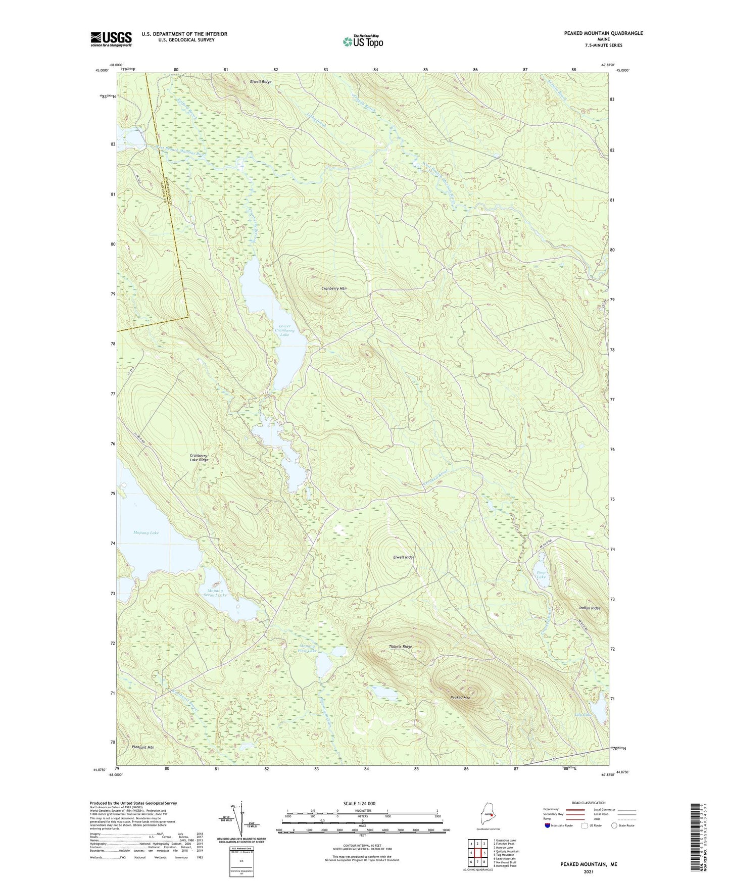
2024 topographic map quadrangle Peaked Mountain in the state of Maine. Scale: 1:24000. Based on the newly updated USGS 7.5' US Topo map series, this map is in the following counties: Washington, Hancock. The map contains contour data, water features, and other items you are used to seeing on USGS maps, but also has updated roads and other features. This is the next generation of topographic maps. Printed on high-quality waterproof paper with UV fade-resistant inks.
Quads adjacent to this one:
West: Quillpig Mountain
Northwest: Gassabias Lake
North: Fletcher Peak
Northeast: Monroe Lake
East: Tug Mountain
Southeast: Montegail Pond
South: Northeast Bluff
Southwest: Lead Mountain
This map covers the same area as the classic USGS quad with code o44067h8.
Contains the following named places: Cranberry Lake Ridge, Cranberry Mountain, Cranberry Stream, Elwell Dam, Elwell Ridge, Indian Ridge, Ingalls Brook, Libby Brook, Lily Lake, Lower Cranberry Lake, Lower Pond, Lower Sabao Lake Dam, Mopang First Lake, Mopang Second Lake, Mopang Second Lake Dam, Peaked Mountain, Peep Lake, Rolford Brook, Rolford Dam, T30 MD BPP, Tibbets Ridge, Upper Cranberry Lake