MyTopo
Grand Lake Seboeis Maine US Topo Map
Couldn't load pickup availability
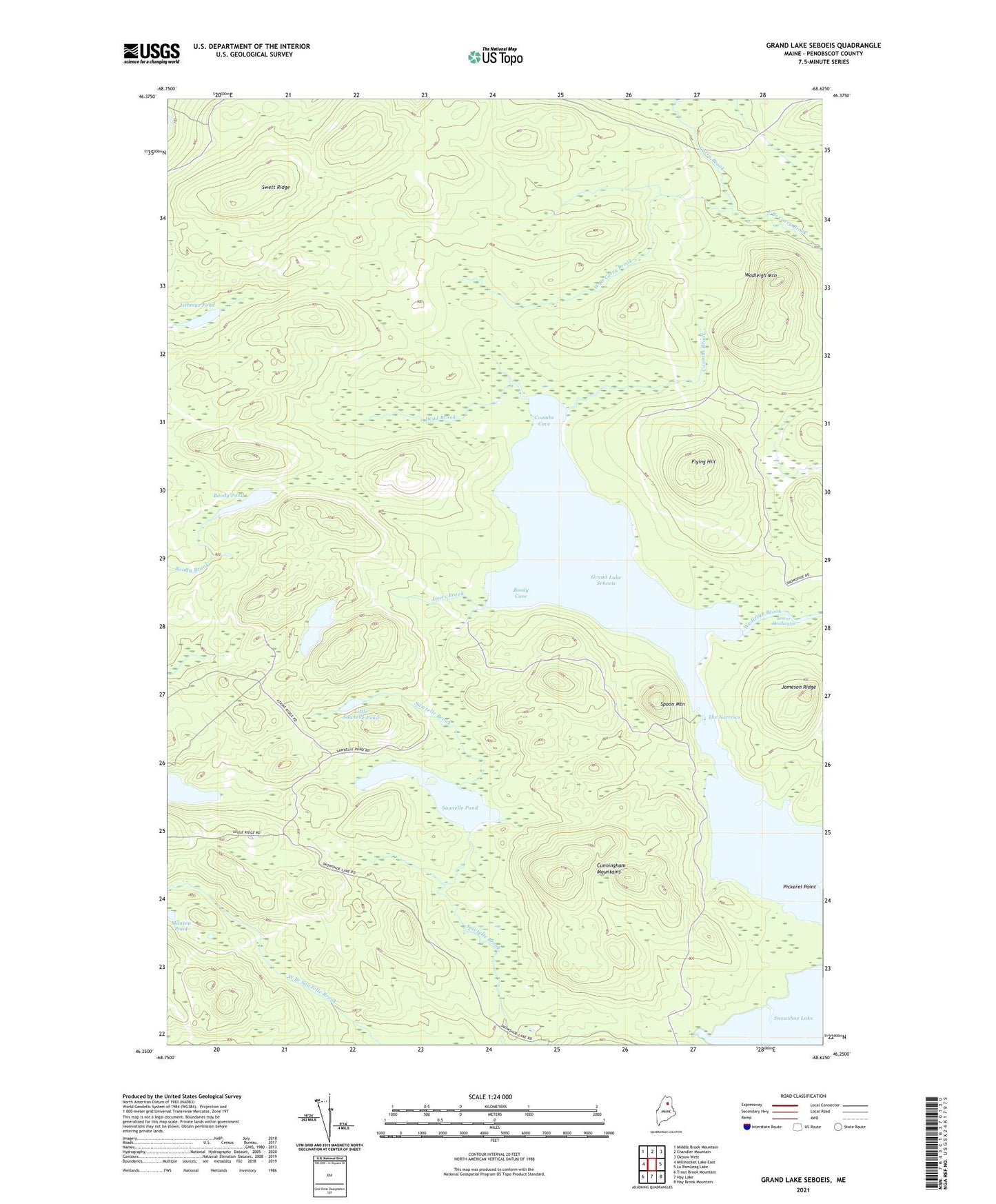
2021 topographic map quadrangle Grand Lake Seboeis in the state of Maine. Scale: 1:24000. Based on the newly updated USGS 7.5' US Topo map series, this map is in the following counties: Penobscot. The map contains contour data, water features, and other items you are used to seeing on USGS maps, but also has updated roads and other features. This is the next generation of topographic maps. Printed on high-quality waterproof paper with UV fade-resistant inks.
Quads adjacent to this one:
West: Millinocket Lake East
Northwest: Middle Brook Mountain
North: Chandler Mountain
Northeast: Oxbow West
East: La Pomkeag Lake
Southeast: Hay Brook Mountain
South: Hay Lake
Southwest: Trout Brook Mountain
Contains the following named places: Boody Cove, Boody Pond, Coombs Brook, Coombs Cove, Cunningham Mountains, Dead Brook, East Branch Carry Brook, Flying Hill, Grand Lake Seboeis, Isthmus Pond, Jameson Ridge, Jones Brook, Jones Pond, Little Sawtelle Pond, Manton Pond, Millinocket Lake Tote Road, Pickerel Point, Sawtelle Pond, Snowshoe Lake, Spoon Mountain, Swett Ridge, T7 R7 WELS, T8 R7 WELS, The Narrows, Wadleigh Brook, Wadleigh Mountain, West Branch Carry Brook