MyTopo
La Pomkeag Lake Maine US Topo Map
Couldn't load pickup availability
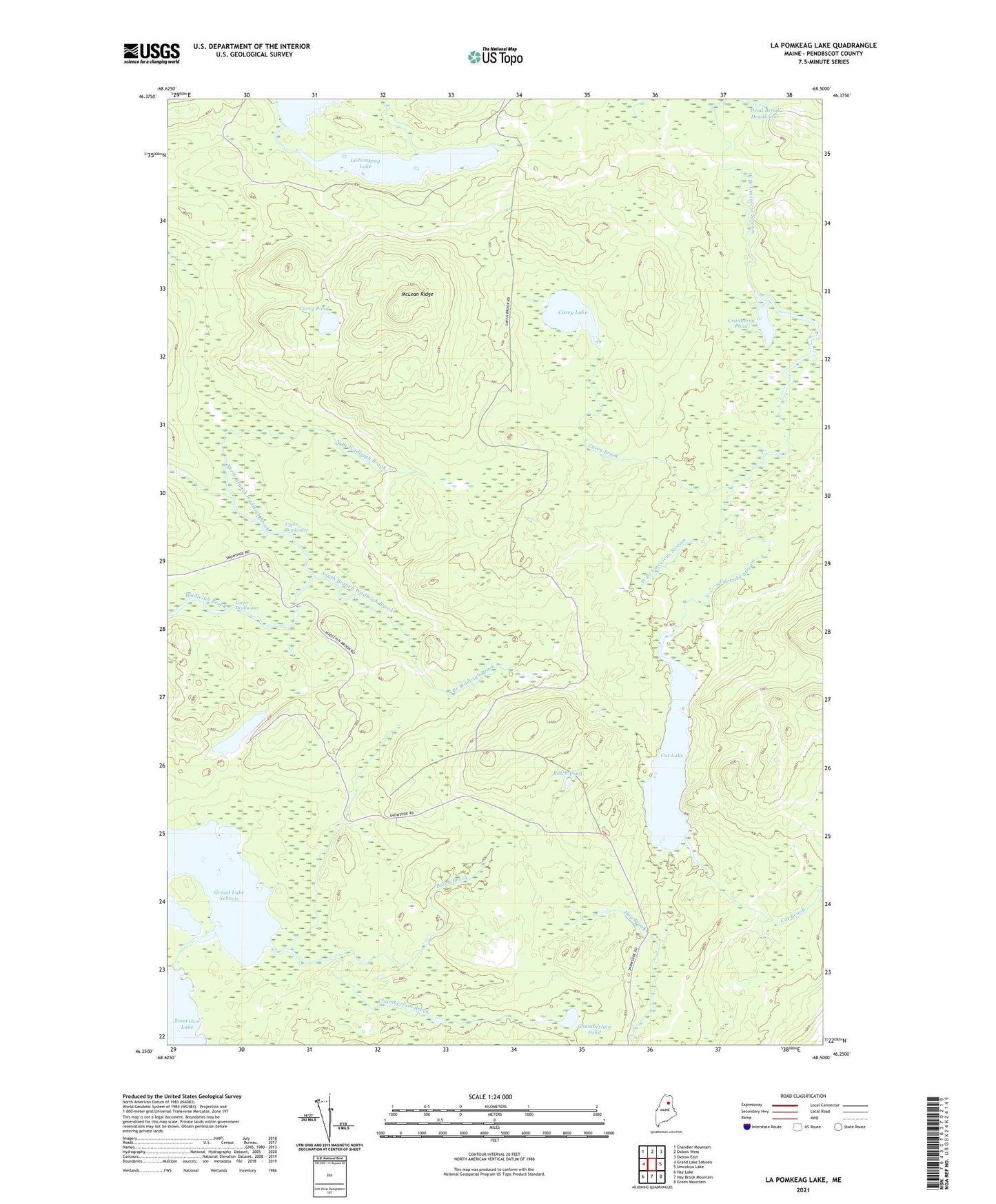
2024 topographic map quadrangle La Pomkeag Lake in the state of Maine. Scale: 1:24000. Based on the newly updated USGS 7.5' US Topo map series, this map is in the following counties: Penobscot. The map contains contour data, water features, and other items you are used to seeing on USGS maps, but also has updated roads and other features. This is the next generation of topographic maps. Printed on high-quality waterproof paper with UV fade-resistant inks.
Quads adjacent to this one:
West: Grand Lake Seboeis
Northwest: Chandler Mountain
North: Oxbow West
Northeast: Oxbow East
East: Umcolcus Lake
Southeast: Green Mountain
South: Hay Brook Mountain
Southwest: Hay Lake
This map covers the same area as the classic USGS quad with code o46068c5.
Contains the following named places: Batch Brook, Batch Pond, Carey Brook, Carey Lake, Carry Pond, Chamberlain Brook, Chamberlain Pond, Cranberry Pond, Cut Brook, Cut Lake, Cut Lake Stream, Dead Brook, Dead Brook Deadwater, Dunn Camp, Foster Camp, Frazier Camp, LaPomkeag Lake, Lost Pond, Lower Deadwater, Lower LaPomkeag Lake, McLean Ridge, North Branch Wadleigh Brook, South Branch Wadleigh Brook, T7 R6 WELS, T8 R6 WELS, Umcolcus Deadwater, Upper Deadwater