MyTopo
Olamon Maine US Topo Map
Couldn't load pickup availability
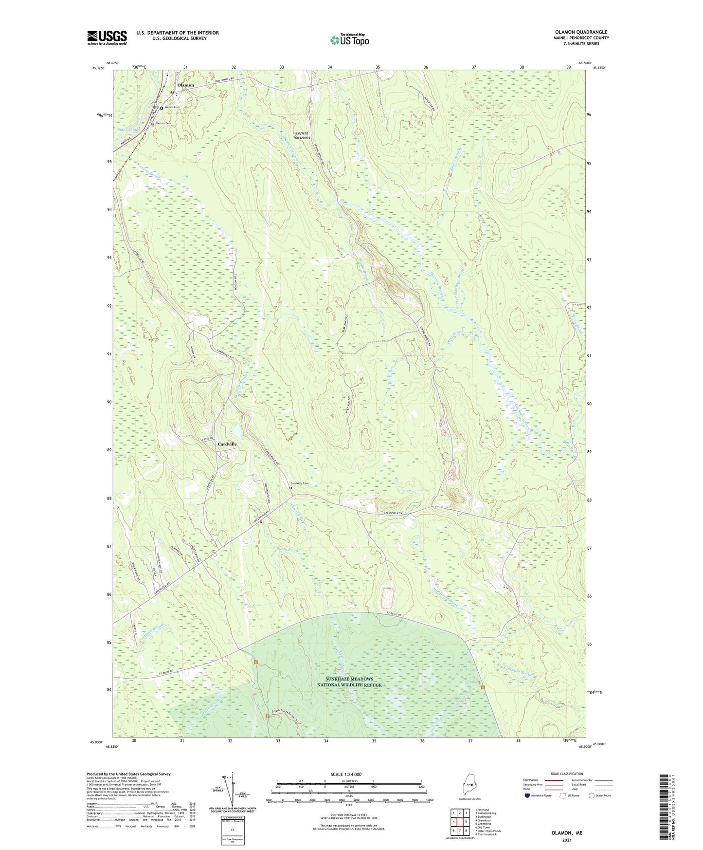
2024 topographic map quadrangle Olamon in the state of Maine. Scale: 1:24000. Based on the newly updated USGS 7.5' US Topo map series, this map is in the following counties: Penobscot. The map contains contour data, water features, and other items you are used to seeing on USGS maps, but also has updated roads and other features. This is the next generation of topographic maps. Printed on high-quality waterproof paper with UV fade-resistant inks.
Quads adjacent to this one:
West: Greenbush
Northwest: Howland
North: Passadumkeag
Northeast: Burlington
East: Greenfield
Southeast: The Horseback
South: Otter Chain Ponds
Southwest: Old Town
This map covers the same area as the classic USGS quad with code o45068a5.
Contains the following named places: Bear Brook, Cardville, Cardville Cemetery, Cardville Church, Dennis Cemetery, Enfield Horseback, Fulton Bridge, Greenbush Fire Department - James C Haverlock Station, Greenbush Volunteer Fire Department Sherman Station, Halfway Brook, Helen Dunn Elementary School, Olamon, Olamon Island, Olamon Post Office, Otter Brook, Parker Meadow Brook, Poplar Brook, Scotts Corners, Side Channel, Smart Brook, Spring Bridge, Town of Greenbush, United Pentecostal Church, Welles Cemetery, Whitney Brook