
MyTopo
Jonesport Maine US Topo Map
Couldn't load pickup availability
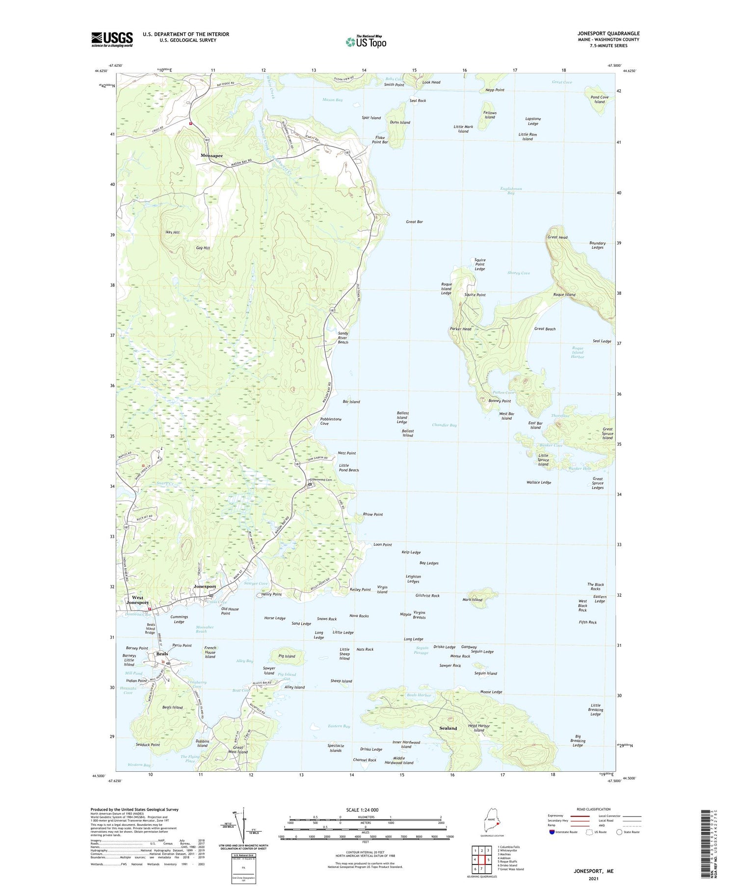
2021 topographic map quadrangle Jonesport in the state of Maine. Scale: 1:24000. Based on the newly updated USGS 7.5' US Topo map series, this map is in the following counties: Washington. The map contains contour data, water features, and other items you are used to seeing on USGS maps, but also has updated roads and other features. This is the next generation of topographic maps. Printed on high-quality waterproof paper with UV fade-resistant inks.
Quads adjacent to this one:
West: Addison
Northwest: Columbia Falls
North: Whitneyville
Northeast: Machias
East: Roque Bluffs
South: Great Wass Island
Southwest: Drisko Island
Contains the following named places: Alley Bay, Alley Island, Ballast Island, Ballast Island Ledge, Bar Island, Barney Point, Barneys Little Island, Bay Ledges, Beals, Beals Elementary School, Beals Harbor, Beals Island, Beals Island Bridge, Beals Post Office, Big Breaking Ledge, Boat Cove, Bonney Point, Boundary Ledges, Bunker Cove, Bunker Hole, Chandler Bay, Chandler River, Channel Rock, Coast Guard Station Jonesport, Cranberry Cove, Cross Cove, Cummings Ledge, Dobbins Island, Donovan Cove, Drisko Ledge, Dunn Island, East Bar Island, Eastern Ledge, Fellows Island, Fifth Rock, Flake Point Bar, French House Island, Gangway, Gay Hill, Gilchrist Rock, Great Bar, Great Beach, Great Head, Great Spruce Island, Great Spruce Ledges, Greenwood Cemetery, Hannahs Cove, Head Harbor Creek, Head Harbor Island, Henry Point, Horse Ledge, Ikes Hill, Indian Point, Inner Hardwood Island, Jonesport, Jonesport Beals High School, Jonesport Census Designated Place, Jonesport City Police Department, Jonesport Elementary School, Jonesport Post Office, Jonesport Volunteer Fire Department, Jonesport Volunteer Fire Department Mason Bay Substation, Kelley Point, Kelley School, Kelp Ledge, Lapstone Ledge, Leighton Ledges, Libby Creek, Little Breaking Ledge, Little Ledge, Little Mark Island, Little Pond Beach, Little Ram Island, Little Sheep Island, Little Spruce Island, Long Ledge, Loon Point, Mansfield Creek, Mark Island, Mason Bay, Middle Hardwood Island, Mill Pond, Monsapec, Moosabec Ambulance Service, Moosabec Reach, Moose Ledge, Moose Rock, Nats Rock, Natt Point, Nepp Point, Nipple, Nova Rocks, Old House Point, Parker Head, Patten Cove, Peabody Memorial Library, Perio Point, Pig Island, Pig Island Gut, Pobblestone Cove, Pond Cove Island, Rhine Point, Roque Island, Roque Island Harbor, Roque Island Ledge, Sand Ledge, Sandy River, Sandy River Beach, Sawyer Cove, Sawyer Island, Sawyer Rock, Seaduck Point, Seal Ledge, Seal Rock, Sealand, Seguin Island, Seguin Ledge, Seguin Passage, Sheep Island, Shorey Cove, Smith Point, Snare Creek, Snare Creek Dam, Snows Rock, Southwest Creek, Spar Island, Spectacle Islands, Squire Point, Squire Point Ledge, The Flying Place, Thorofare, Town of Jonesport, Upper Bay District School, Virgin Island, Virgins Breasts, Wallace Ledge, West Bar Island, West Black Rock, West Jonesport, White Creek


