MyTopo
Lincoln Center Maine US Topo Map
Couldn't load pickup availability
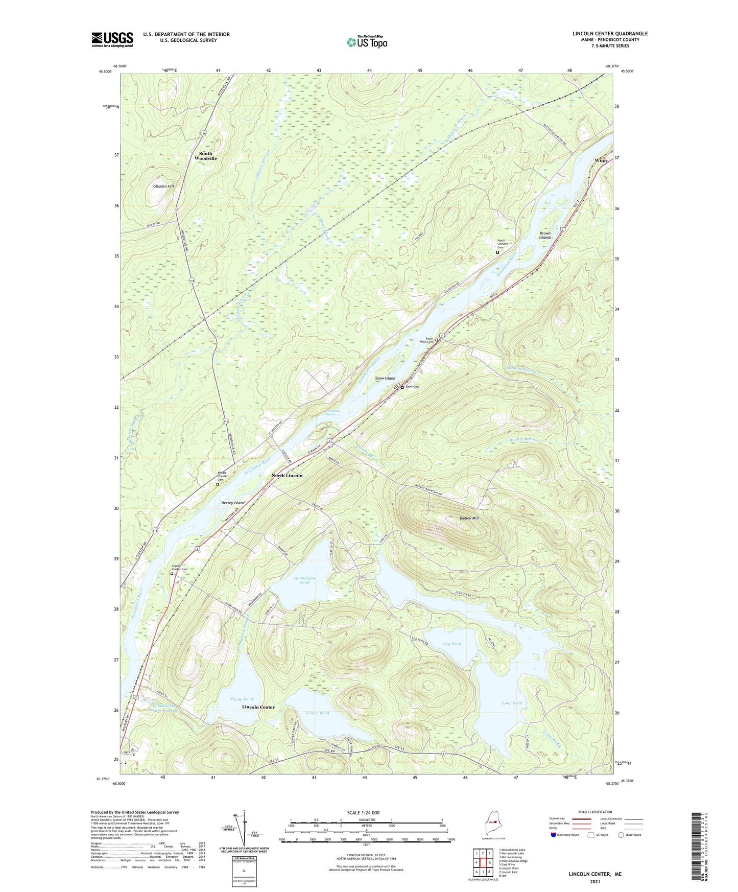
2024 topographic map quadrangle Lincoln Center in the state of Maine. Scale: 1:24000. Based on the newly updated USGS 7.5' US Topo map series, this map is in the following counties: Penobscot. The map contains contour data, water features, and other items you are used to seeing on USGS maps, but also has updated roads and other features. This is the next generation of topographic maps. Printed on high-quality waterproof paper with UV fade-resistant inks.
Quads adjacent to this one:
West: Nine Meadow Ridge
Northwest: Medunkeunk Lake
North: Mattaseunk Lake
Northeast: Mattawamkeag
East: East Winn
Southeast: Lee
South: Lincoln East
Southwest: Lincoln West
This map covers the same area as the classic USGS quad with code o45068d4.
Contains the following named places: Bagley Mountain, Blood Brook, Brown Islands, Cambolasse Pond, Cambolasse Stream, Cambolasse Stream Reservoir, Caribou Pond, Center Pond, Chester, Chester Siding, Egg Pond, Ella P Burr Elementary School, Flowers Brook, Glidden Hill, Hersey Island, Lincoln Center, Lincoln Center Cemetery, Long Pond, Long Pond Dam, Marianne School, Mattanawcook Academy, Middle Chester Cemetery, Mill Pond Dam, North Chester Cemetery, North Lincoln, Salmon Stream, Sebonibus Rapids, Smith Brook, Snag Pond Dam, Snow Cemetery, Snow Island, South Winn Cemetery, South Woodville, Stump Pond, Tobin Brook, ZIP Code: 04457