MyTopo
Lincoln East Maine US Topo Map
Couldn't load pickup availability
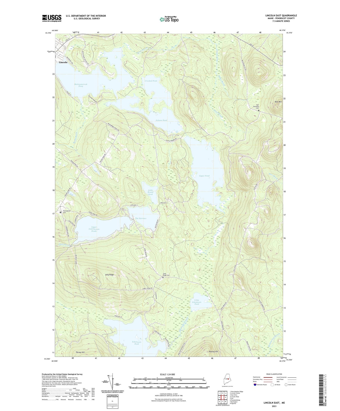
2024 topographic map quadrangle Lincoln East in the state of Maine. Scale: 1:24000. Based on the newly updated USGS 7.5' US Topo map series, this map is in the following counties: Penobscot. The map contains contour data, water features, and other items you are used to seeing on USGS maps, but also has updated roads and other features. This is the next generation of topographic maps. Printed on high-quality waterproof paper with UV fade-resistant inks.
Quads adjacent to this one:
West: Lincoln West
Northwest: Nine Meadow Ridge
North: Lincoln Center
Northeast: East Winn
East: Lee
Southeast: Saponac
South: Burlington
Southwest: Passadumkeag
This map covers the same area as the classic USGS quad with code o45068c4.
Contains the following named places: Cold Stream Dam, Crooked Pond, Dead Stream, Dow Mountain, Eskutassis Pond, Folsom Pond, Folsom Pond Dam, Half Township Cemetery, Libby Corner, Lincoln Census Designated Place, Little Eskutassis Pond, Little Round Pond, Long Ridge, Long Ridge Cemetery, Long Ridge School, Mattanawcook Junior High School, Mattanawcook Pond, Rocky Brook, The Narrows, Town of Lincoln, Transalpine Cemetery, Tribou Brook, Upper Cold Stream Ponds, Upper Pond, Upper Pond Dam