MyTopo
Mattamiscontis Mountain Maine US Topo Map
Couldn't load pickup availability
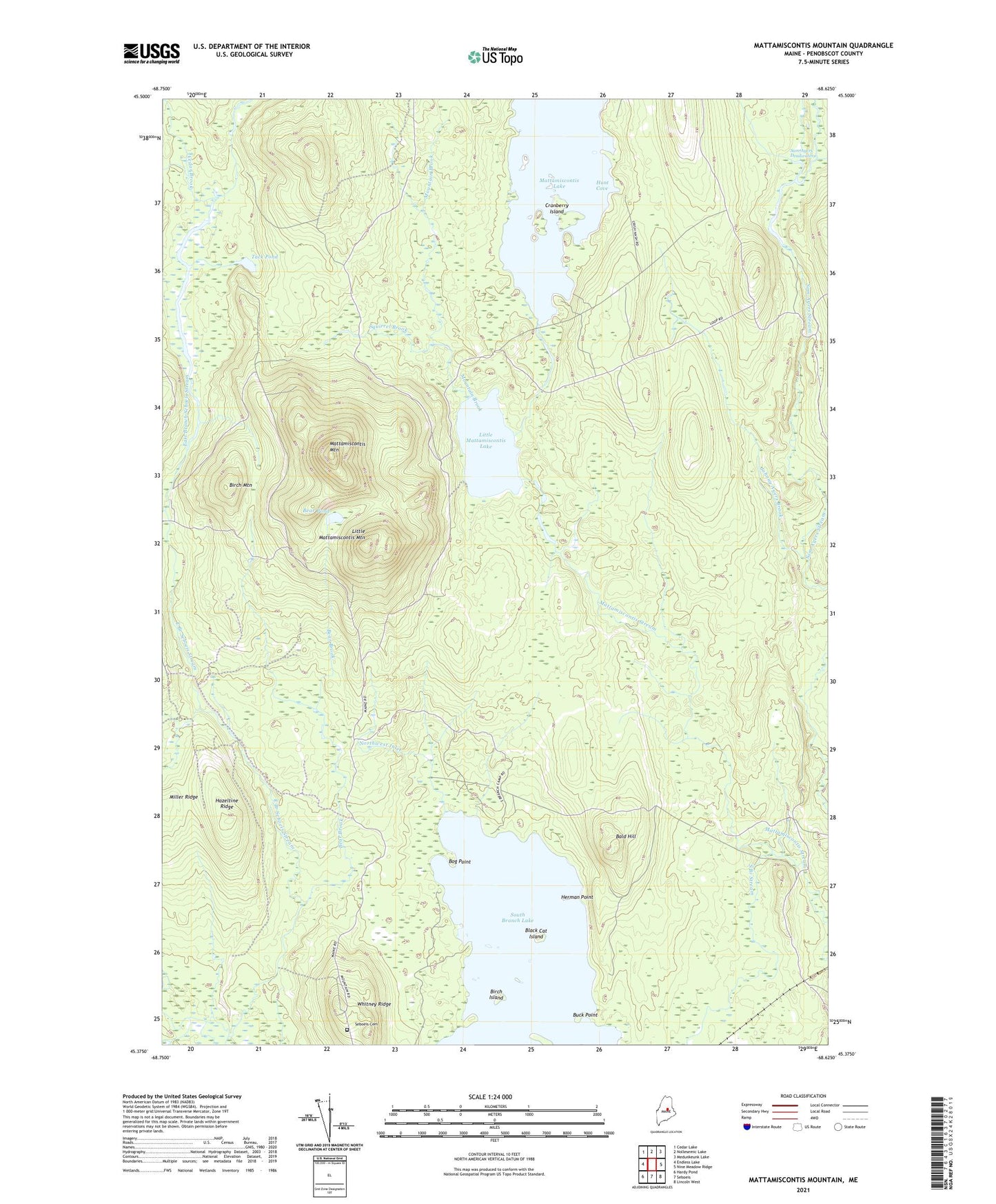
2024 topographic map quadrangle Mattamiscontis Mountain in the state of Maine. Scale: 1:24000. Based on the newly updated USGS 7.5' US Topo map series, this map is in the following counties: Penobscot. The map contains contour data, water features, and other items you are used to seeing on USGS maps, but also has updated roads and other features. This is the next generation of topographic maps. Printed on high-quality waterproof paper with UV fade-resistant inks.
Quads adjacent to this one:
West: Endless Lake
Northwest: Cedar Lake
North: Nollesemic Lake
Northeast: Medunkeunk Lake
East: Nine Meadow Ridge
Southeast: Lincoln West
South: Seboeis
Southwest: Hardy Pond
This map covers the same area as the classic USGS quad with code o45068d6.
Contains the following named places: Bald Hill, Bear Brook, Bear Pond, Birch Island, Birch Mountain, Black Cat Island, Bog Brook, Bog Point, Buck Point, Cedar Brook, Cranberry Island, Dutch Island, East Branch Seboeis Stream, Gray Ledge Deadwater, Hazeltine Ridge, Herman Point, Hunt Cove, Johnny Ayers Brook, Little Mattamiscontis Lake, Little Mattamiscontis Mountain, Mattamiscontis Club Camp, Mattamiscontis Lake, Mattamiscontis Mountain, Mountain Brook, Northwest Inlet, Penobscot County, Penobscot Reservation, Plantation of Seboeis, Sam Ayers Deadwater, Sam Ayers Stream, Seboeis Cemetery, Shore Road Trail, South Branch Lake, South Branch Stream, Squirrel Brook, Sweat Bog Brook, Tack Pond, West Branch Seboeis Stream, Whitney Ridge