MyTopo
Endless Lake Maine US Topo Map
Couldn't load pickup availability
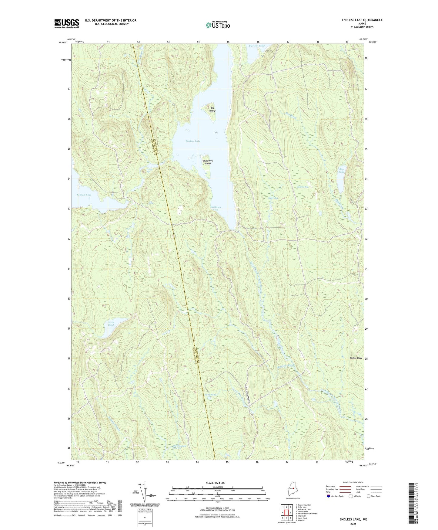
2024 topographic map quadrangle Endless Lake in the state of Maine. Scale: 1:24000. Based on the newly updated USGS 7.5' US Topo map series, this map is in the following counties: Penobscot, Piscataquis. The map contains contour data, water features, and other items you are used to seeing on USGS maps, but also has updated roads and other features. This is the next generation of topographic maps. Printed on high-quality waterproof paper with UV fade-resistant inks.
Quads adjacent to this one:
West: Seboeis Lake
Northwest: Ragged Mountain
North: Cedar Lake
Northeast: Nollesemic Lake
East: Mattamiscontis Mountain
Southeast: Seboeis
South: Hardy Pond
Southwest: Milo North
This map covers the same area as the classic USGS quad with code o45068d7.
Contains the following named places: Big Island, Blueberry Island, Bog Pond, Caribou Bog, Cedar Lake Township, Deadman Cove, Dudley Rips, Endless Lake, Lake Trail, Lard Camp Trail, Lard Pond, Lower Deadwater, Miller Bog, Miller Ridge, One Thousand Acre Bog, Otter Brook, Roaring Brook, Seboeis Dam, Seboeis Lake, Shore Trail, Turtle Pond, Upper Deadwater