MyTopo
Seboeis Maine US Topo Map
Couldn't load pickup availability
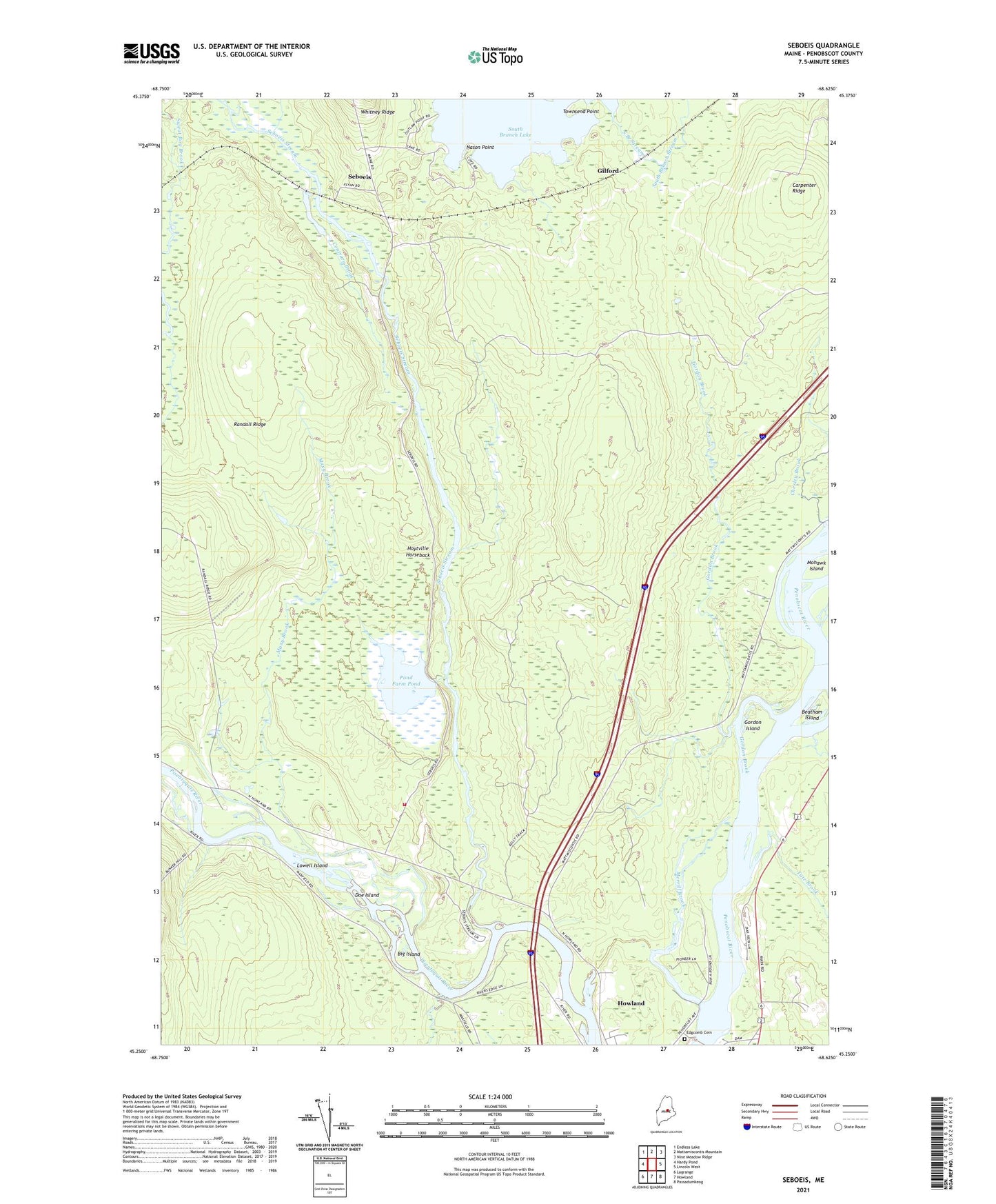
2024 topographic map quadrangle Seboeis in the state of Maine. Scale: 1:24000. Based on the newly updated USGS 7.5' US Topo map series, this map is in the following counties: Penobscot. The map contains contour data, water features, and other items you are used to seeing on USGS maps, but also has updated roads and other features. This is the next generation of topographic maps. Printed on high-quality waterproof paper with UV fade-resistant inks.
Quads adjacent to this one:
West: Hardy Pond
Northwest: Endless Lake
North: Mattamiscontis Mountain
Northeast: Nine Meadow Ridge
East: Lincoln West
Southeast: Passadumkeag
South: Howland
Southwest: Lagrange
This map covers the same area as the classic USGS quad with code o45068c6.
Contains the following named places: Barnes Brook, Beatham Island, Big Island, Carpenter Ridge, Chesley Brook, Contrary Brook, Doe Island, Gilford, Gordon Brook, Gordon Island, Howland Census Designated Place, Hoytville Horseback, Lowell Island, Mattamiscontis Township, Maxy Brook, Meadow Brook, Merrill Brook, Mohawk Island, Nason Point, Penobscot River Reservoir, Pond Farm Pond, Pond Farm Pond Dam, Pond Farm State Wildlife Management Area, Randall Ridge, Seboeis, Seboeis Plantation Volunteer Fire Department, Seboeis Stream, Tate Brook, Town of Howland, Townsend Point, West Enfield Dam, ZIP Code: 04448