MyTopo
Metallak Mountain Maine US Topo Map
Couldn't load pickup availability
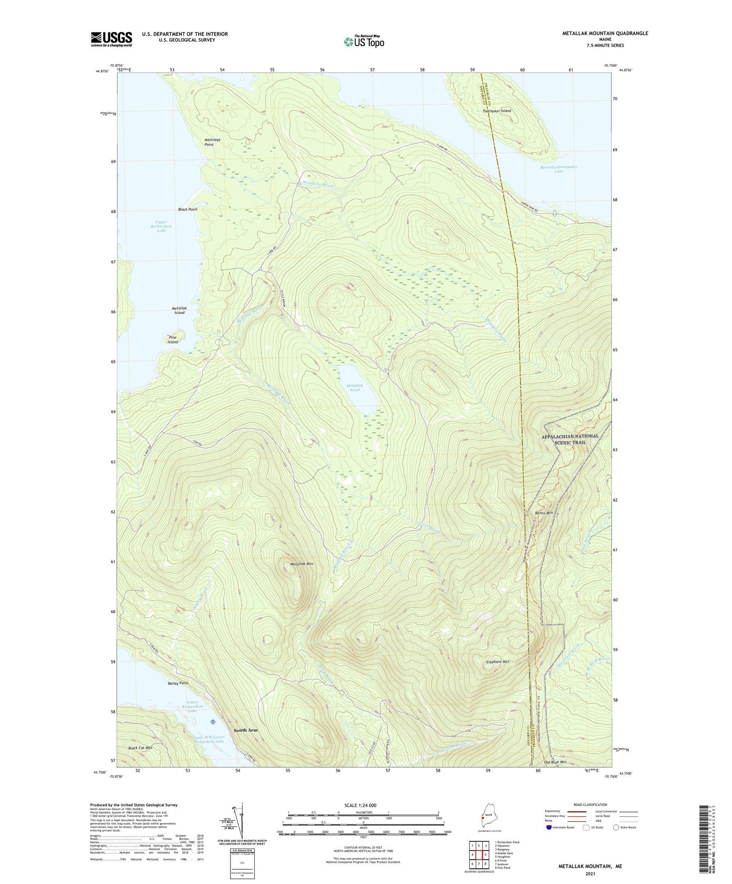
2021 topographic map quadrangle Metallak Mountain in the state of Maine. Scale: 1:24000. Based on the newly updated USGS 7.5' US Topo map series, this map is in the following counties: Oxford, Franklin. The map contains contour data, water features, and other items you are used to seeing on USGS maps, but also has updated roads and other features. This is the next generation of topographic maps. Printed on high-quality waterproof paper with UV fade-resistant inks.
Quads adjacent to this one:
West: Middle Dam
Northwest: Richardson Pond
North: Oquossoc
Northeast: Rangeley
East: Houghton
Southeast: Ellis Pond
South: Andover
Southwest: B Pond
Contains the following named places: Bailey Brook, Bailey Point, Bemis Mountain, Black Point, Elephant Mountain, Icicle Brook, Metallak Brook, Metallak Island, Metallak Mountain, Metallak Pond, Metallak Stream, Mosquito Brook, Pine Island, Richardsontown Township, South Arm, South Arm Campground, South Arm Lower Richardson Lake, Toothaker Island, Upper Richardson Lake, Whitneys Point, ZIP Code: 04964