MyTopo
Mount Kineo Maine US Topo Map
Couldn't load pickup availability
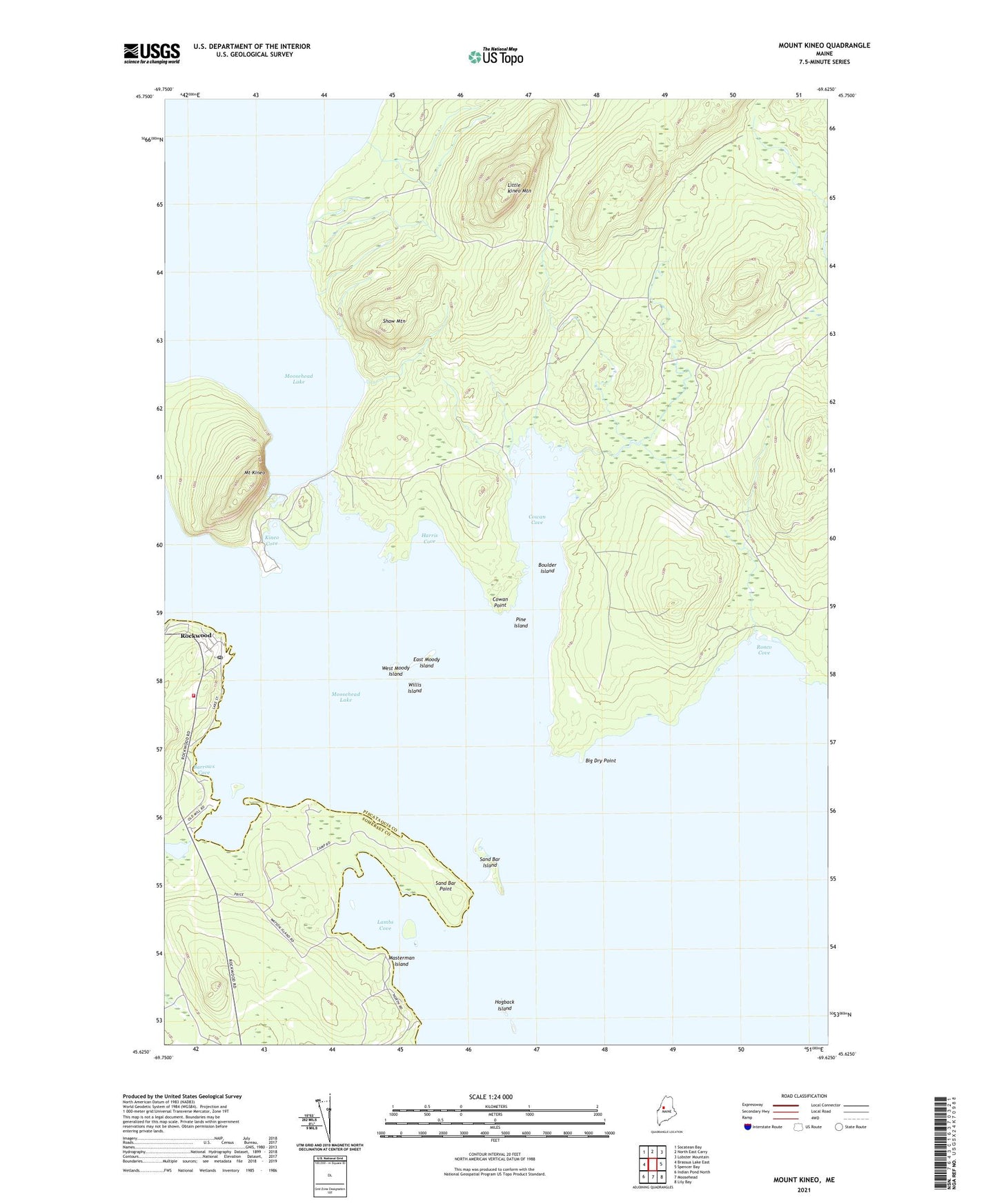
2021 topographic map quadrangle Mount Kineo in the state of Maine. Scale: 1:24000. Based on the newly updated USGS 7.5' US Topo map series, this map is in the following counties: Piscataquis, Somerset. The map contains contour data, water features, and other items you are used to seeing on USGS maps, but also has updated roads and other features. This is the next generation of topographic maps. Printed on high-quality waterproof paper with UV fade-resistant inks.
Quads adjacent to this one:
West: Brassua Lake East
Northwest: Socatean Bay
North: North East Carry
Northeast: Lobster Mountain
East: Spencer Bay
Southeast: Lily Bay
South: Moosehead
Southwest: Indian Pond North
Contains the following named places: Barrows Cove, Beaver Brook, Beaver Ponds, Big Dry Point, Boulder Island, Cowan Brook, Cowan Cove, Cowan Point, Days Academy Grant Township, Deer Head Farm, East Moody Island, Farm Brook, Frog Pond, Harris Cove, Hogback Island, Kineo Cove, Kineo Township, Lambs Cove, Little Kineo Mountain, Masterman Island, Mount Kineo, Pine Island, Rockwood, Rockwood Fire and Rescue Department, Ronco Brook, Ronco Cove, Sand Bar Island, Sand Bar Point, Sandbar Tract Township, Shaw Mountain, West Moody Island, West Outlet Dam, Willis Island