MyTopo
New Harbor Maine US Topo Map
Couldn't load pickup availability
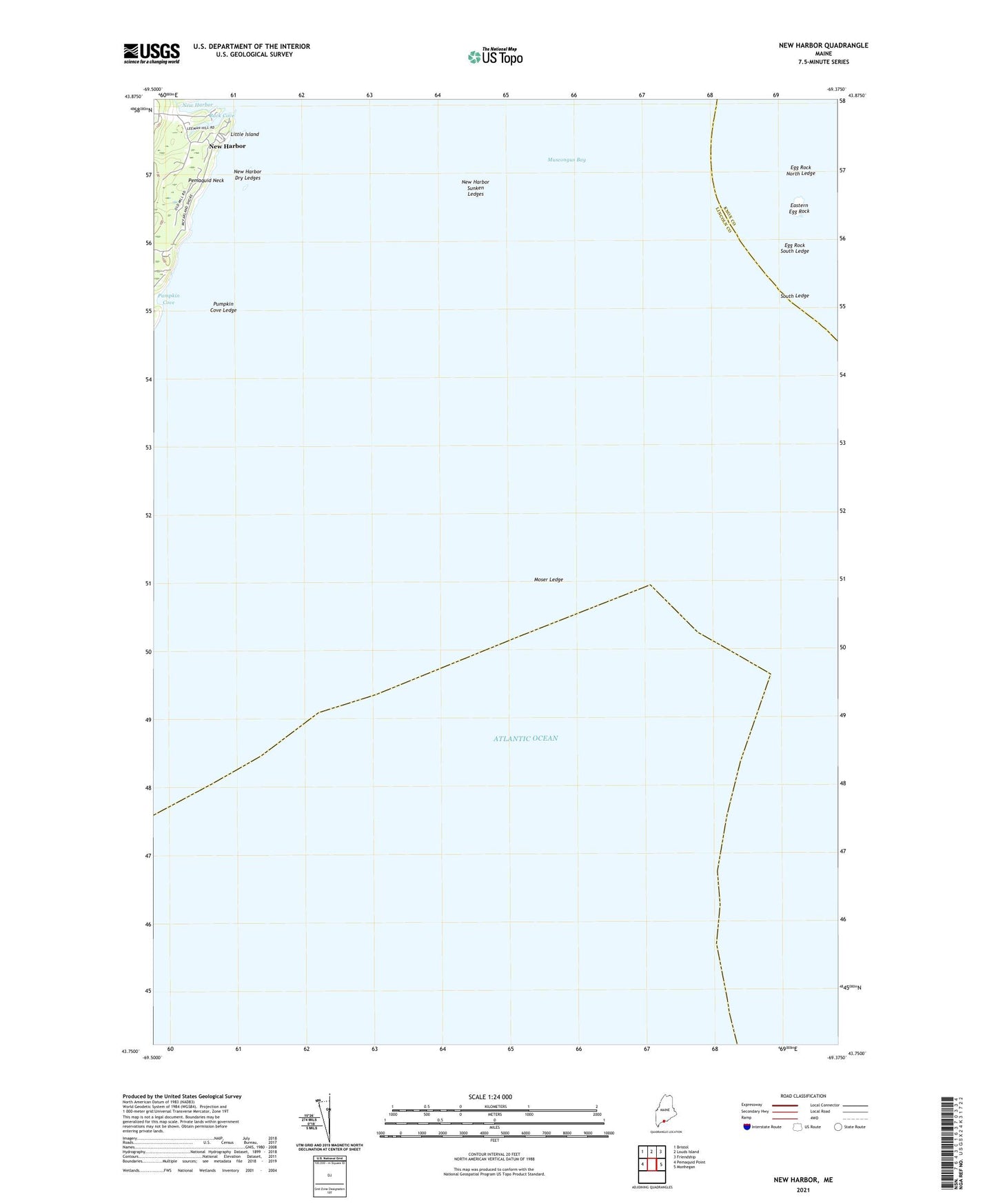
2024 topographic map quadrangle New Harbor in the state of Maine. Scale: 1:24000. Based on the newly updated USGS 7.5' US Topo map series, this map is in the following counties: Lincoln, Knox. The map contains contour data, water features, and other items you are used to seeing on USGS maps, but also has updated roads and other features. This is the next generation of topographic maps. Printed on high-quality waterproof paper with UV fade-resistant inks.
Quads adjacent to this one:
West: Pemaquid Point
Northwest: Bristol
North: Louds Island
Northeast: Friendship
East: Monhegan
This map covers the same area as the classic USGS quad with code o43069g4.
Contains the following named places: Back Cove, Eastern Egg Rock, Egg Rock North Ledge, Egg Rock South Ledge, Little Island, Moser Ledge, New Harbor, New Harbor Dry Ledges, New Harbor Sunken Ledges, Pumpkin Cove, Pumpkin Cove Ledge, Samoset Memorial, Shaws Wharf, South Ledge, Yellow Head